Monday, 29 February 2016

Ice road opens, with limits, to connect Northern Saskatchewan communities CBC News Posted: Feb 28, 2016 8:50 PM CT


Concepts of Thinking: Spatial Significance, Geographic Perspective, Interrelationships

Inquiry: Why are these Northern communities connected by ice roads? How might Climate Change impact connecting the Northern communities in the future?

Activity: Map out the transportation methods of the Northern communities using. Transportation and population data. Create transportation routes when the lakes are covered. If ice roads will not work in the future due to climate change create new routes by adding in points/lines and polygons. Communicate the rational to an appropriate audience.
March 3rd - Climate Change & Agriculture PIR Live Event - Canadian Agriculture Literacy Week 2016

Concepts of Thinking: Interrelationships, Spatial Significance

Inquiry: How might agricultural practices change due to changes in clime? Where might these changes have the greatest impact? What might some of the impacts be on different populations around the world?

Activity: Investigate the interrelationships of current agricultural practices. Evaluate the role spatial significance plays with regards to certain practices by creating a map in a spatial journal. Analyse the map for patterns and trends. Communicate results making predictions as to how agricultural practice may change due to climate change.

Saturday, 27 February 2016

UK tourists killed by Vietnam waterfall's 'violent waters'  and agencies


Concepts of Thinking: Spatial Significance, Interrelationships, 

Inquiry: How could such an event have been prevented? 

Activity: Create a spatial journal that highlights dangerous tourist locations around the world. Identify patterns and trends and develop a travel advisory to help tourist be aware of some of the dangers of travel. Communicate results to an appropriate audience.

Friday, 26 February 2016

Bison On Track To Return To Banff National Park

 |  By

Concepts of Thinking: Interrelationships, Spatial Significance, Patterns and Trends

Inquiry: Why have people decided to try to bring back the Bison to Alberta? How should the herd be managed to ensure its safety?


Activity: Create a story map outlining the plight of the Bison in North America. Be sure to include the impact human activity and communicate a possible outcomes of the reintroduction of Bison into Alberta.

Thursday, 25 February 2016

The Uprooted

Story sources: UNHCR, Airbus Defense and Space

Concepts of Thinking: Geographic Perspective, Spatial Significance, Patterns and Trends, Interrelationship
Inquiry: How might this crisis end?
Activity: Class discussion. Complete an issue analysis to initiate the discussion. Develop possible solutions to the crisis. 

Related

U.N. Food Airdrop For Besieged Syrians Misses Its Target 


All 21 palettes failed to reach their intended destination unharmed.


 TED2016 · 16:16 · Filmed Feb 2016


Concepts of Thinking: Geographic Perspective, Patterns and Trends

Inquiry: Why might people judge the group based on the activities of a few? Why might people judge  cultural groups with one set of criteria but  their own with another set?

Activity: Complete an issue analysis. Understanding the different stakeholders, their values and beliefs develop a plan of action to help reduce the problems associated with judging groups in a negative way.


Wednesday, 24 February 2016

How much warmer than normal was your city in 2015?

Posted by  in Nature on Tuesday, February 23, 2016


Concepts of Thinking: Spatial Significance, Patterns and Trends

Inquiry: Why does temperature change vary from place to place? How has temperature change impacted people in these different areas? How might this climate impact people in the future?

Activity: Create a map of spatial significance indicating places of greatest temperature change. Add data such as land use, human activity, environmental 
characteristic to help determine impacts and make predictions if patterns continue. Communicate a possible solution/result via story map.

Vancouver Island’s hinterland attracts affordability refugees desperate to buy a family home

Concepts of Thinking: Spatial Significance, Patterns and Trends, Interrelationships

Inquiry: Why might the housing in Vancouver be so expensive? Spatial Significance. What might some of the impacts on city policies be? Interrelationships. What might the future hold if home prices continue to climb? Patterns and Trends.

Activity: Create a map of the Vancouver area of human activity, climatic, land use etc data. Analyse the data to help make predictions on the cost of houses, environmental impacts, population distribution etc. regarding the current situation. Communicate developed prediction via a story map.

5 amazing facts about the St. Lawrence River

Concepts of Thinking: Spatial Significance, Interrelationships

Inquiry: How has human activity contributed o the over all health of the river? Might might need to happen in order to improve the river systems health?

Activity: Create a map of the St Lawrence Waterway. Add to it human activity data to help determine how the rivers health has been impacted and develop a plan to help improve the health of the river system.

Tuesday, 23 February 2016

US, Canada aim to cut Lake Erie phosphorus runoff by 40%

Concepts of Thinking: Interrelationships, Spatial Significance, Geographic Perspective

Inquiry: What might have caused the levels of phosphorus to get to levels that need to be reduced? How might Canada and the US agree to reduce the levels? What might some implications be if levels do not return to normal?

Activity: Conduct an issue analysis to help develop a potential solution to the problem. Map the extent to which the algae bloom has grown. Use water current data to determine future implications.

Peru oil spill pollutes Amazon rivers used by indigenous group  BBC

Concepts of Thinking: Spatial Significance, Interrelationships, Geographic Perspective

Inquiry: Why might oil exploration in such sensitive areas have been approved? Who  might be responsible for this spill, the workers? the companies? the consumers? How might this be thoroughly cleaned up?

Activity: Collect data on the spatial significance of the area, plot where it happened, add human activity in the area. Create buffers to determine how far the spill might impact and make predictions.Complete an issue analysis of the problem to determine a possible solution. Communicate predictions and solution in a story map.

9 Deadliest Rocks And Minerals On Earth 


Concepts of Thinking: Spatial Significance, Interrelationships

Inquiry: Where might these rocks/mineral be located? Why might might these rocks and minerals be there? How might these rocks and minerals impact human activity?

Activity: Map out the spatial significance of where these rocks and minerals can be found. Add things like soil type, land form type and human activity to enhance the analysis. what might some of the interrelationships be with these rocks and minerals? Create a story map to communicate your results to an appropriate audience.

Friday, 19 February 2016

Prediction of ground motion and dynamic stress change in Baekdusan (Changbaishan) volcano caused by a North Korean nuclear explosion

Concepts of Thinking: Interrelationships, Spatial Significance

Inquiry: How could a nuclear test contribute to a volcanic eruption

Activity: Analyse data and determine how a nuclear test could cause a volcanic eruptions. Map out other sites that could have similar events occur. Analyse maps to determine who might be impacted and what can be done to help these populations.


Decision on burying nuclear waste near Lake Huron delayed for more study 

The Canadian Press 

Published Thursday, February 18, 2016
Concepts of Thinking: Spatial Significance, Geographic Perspective,

Inquiry: How can nuclear waste be disposed of safely? What is where? How is an ideal waste disposal site selected? Why there? If not here then where should the nuclear waste be disposed of? Why Care? 

Activity: Collect information on the characteristics of a nuclear waste disposal site i.e. geology of an area and map out using ArcGIS Online. Add to it data such as population, water and other relevant data (dependent on audience). Do an analysis of the map, such as creating buffers, to determine an idea location to dispose of the waste. Complete an issue analysis and the communicate via story map to the appropriate audience.

Thursday, 18 February 2016

US 'likely culprit' of global spike in methane emissions over last decade

Concept of Thinking: Interrelationships, Spatial Significance. Patterns and Trends

Inquiry: Why has methane gas emissions in the USA increased so much? How might reducing methane emissions impact society?

Activity: Create an interactive map via ArcGIS Online to locate where emissions have increase and activities that contribute to increased emissions to determine the spatial significance of the issue. Can any patterns be observed? Communicate the patterns that are observed to an appropriate audience to create change. 

Turkish Air Strikes Hit PKK Camps In Northern Iraq After Ankara Bombing Reuters


Concepts of Thinking: Geographic Perspective, Spatial Significance

Inquiry: How might the bombing impact the ongoing Syrian conflict? 

Activity: Create a map (spatial journal) of the area incorporating the stakeholders and events related to the conflict and complete an issue analysis to help develop an understanding of the conflict. Communicate a potential solution to the appropriate stakeholder via story map.

Wednesday, 17 February 2016

"Lead helps guard your health": How U.S. companies sold a toxic product

By Matt Pearce, Los Angeles Times
Concepts of Thinking: Interrelationships, Geographic Perspective

Inquiry: How might companies that contributed to the problem be held accountable to society? What might be the best solution to the lead contamination problem?

Activity: Complete an issue analysis of the issue. Create map to indicate where the contaminated water could reach, other treatment plants, and population. Access data on Flint water works to determine how many people could be affected by creating buffers. Communicate results to the appropriate stakeholders via a spatial journal

Romeo Dallaire: ISIS Can't Be Defeated Without Strategy To Help Child Soldiers

Concepts of Thinking: Interrelationships, Geographic Perspective,

Inquiry: Where do Child Soldiers come from? How might children be "trained" to be soldiers? How might Child Soldiers be helped? 

Activity: Create a chloropleth map of countries using child soldiers. Add to it country of origin for the children soldiers. Spatial Significance. Conduct an issue analysis of the issue and communicate a potential solution.
Extension: graph out statistics on Child Soldiers to determine patterns and trends and make some predictions.

Tuesday, 16 February 2016

U.N. working group suggests U.S. work on racial reconciliation By Jesse J. Holland, Associated Press

Concepts of Thinking: Interrelationships, Geographic Perspective

Inquiry: Why would an organization such as the UN have to suggest that Slavery in the USA was a crime against humanity? Why, after all this time, hasn't it been classified as such? What impacts might this crime against humanity classification have in the US and Canada?


Activity:Develop a spatial journal of the issue. What is where? Complete an issue analysis  of the issue. Why there?  Evaluate the map and make suggestions and make recommendations that can be communicated to the different stakeholders to promote change. Why care?

Ceasefire Doesn’t Mean Parties 'Stop Using Weapons,' According To Syria's Assad

Concepts of Thinking: Patterns and Trends, Interrelationship

Inquiry: How might the "powers" who implemented the cease fire in Syria react to the Syrian government not following through with the cease fire?

Activity: Complete an issue analysis of the current twist in this conflict. How should the "powers" proceed if bringing this conflict to an end is indeed the goal? Continue adding this information to a spatial journal

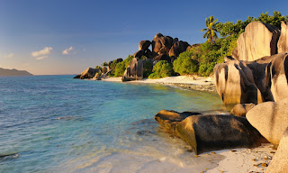
12 beaches with wow factor Guardian writers

Concepts of Thinking: Spatial Significance

Inquiry: What spatial significance gives these locations the WOW factor (other not being in the snow)? Which beach would be the best retreat and for who?

Activity: Do some further research to collect  beach data on cost, number of visitors to create an interactive spatial journal. Use proportional size symbols to indicate cost, popularity etc. Which beach is the best and for who?

Friday, 12 February 2016

26 Most Beautiful Winter Cities

Concepts of Thinking: Spatial Significance, Interrelationship, Patterns and Trends, Geographic Perspective

Inquiry: What might be some common characteristics that make these cities regarded as the most beautiful cities? What might be the most efficient way to visit these locations?

Activity: Create a spatial journal of these most Beautiful cities to help determine spatial significance. What is where? Analyse the characteristic of the places on the map to determine: Why there? Design a route that would be the most efficient for someone to follow and see all these beautiful places.Why care? 
Extension: Using the same criteria for what makes the city beautiful, identify other potential cities that could be placed on this list and explain why in a story map.

Thursday, 11 February 2016

Toxic chemicals found in beached pilot whales in Scotland

Concepts of Thinking: Spatial Significance, Interrelationships, Patterns and Trends, Geographic Perspective

Inquiry: Why might age contribute to the increases levels of mercury and cadmium. How might increased levels of these chemicals contribute to the whales beaching themselves? Where could these chemicals have come from?

Activity: Create a spatial journal of where these whales were beached (What is where?). Add to it possible locations where mercury and cadmium could have entered the water (Why there?). As well add other locations where whales have beached themselves. Analyse the patterns and trends that may appear, investigate the stakeholders and make suggestions how to ensure this does not happen in the future (Why Care?).

Report on Syria conflict finds 11.5% of population killed or injured 
 Middle East editor
Concepts of thinking: Geographic Perspective, Patterns and Trends, Spatial Significane
Inquiry: At what point might it be possible for UN to label this conflict a Genocide?
Activity: Use an issue analysis chart to help develop a solution to this conflict. Map out the Stakeholder, manage the data in a spatial journal to create a visual of the spatial significance of the conflict. Communicate your developed solution in a story map to communicate to the appropriate audience...UN?


I

Wednesday, 10 February 2016

What are the top global risks for 2016?

Concepts of Thinking: Spatial Significance,
Geographic Perspective, Patterns and Trends

Inquiry: How were these risks established?

Activity: Map graph and chart the data for interpretation.  Make predictions on what the future risks might be and where they may be located with supporting information.

Exploring Humanitarian Law (EHL)


Concepts of Thinking: Geographic Perspective, Spatial Significance, Interrelationships, Patterns and Trends


Activity: Use this resource to meet Geographic curriculum expectations for wide range of  courses. 

Tuesday, 9 February 2016

Playlist: 5 talks on the future of food

By Maya Inamura on September 4, 2015 in PlaylistTalks
Concepts of Thinking: Interrelationship, Geographic Perspective

Inquiry: How might food sources change in the future? Where might our food come from in the future? How might our diets change in the future?

Activity: Create a map of where food is coming from now and then plot where it might be coming from as the climate changes. How might this change impact communities around the world?

Passengers tell of terror as cruise ship battered by nine-metre waves Reuters

Concepts of Thinking: Spatial Significance, Geographic Perspective

Inquiry: How could such a storm appear without warning? Why didn't the ship avoid the storm by sailing around it?

Activity: Map out the route of a few cruise ships in ArcGIS Online (What is where?). Add in some interesting data about the location (Why there?) . Input some climatic data to and plan the route for the cruise ship that will keep it safe (Why care?).

Monday, 8 February 2016

Dear Dad, I’m Going to Be Called a Whore’. Her Powerful Video Is Now Moving Millions.

1-in-3 women worldwide will experience physical or sexual violence in their lifetime…
Concepts of Thinking: Patterns and Trends, Spatial Significance, Geographic Perspective, Interrelationships

Inquiry: How might a society deal with the problem of violence against women? How is it possible for people to treat people so poorly, it's 2016? 

Activity: Create a spatial journal of violence against women, locally, nationally, internationally (What is where?). Explore to data for patterns and trends (Why there?). Develop an action plan that could  be introduced to help reduce the incidence of violence against women locally, nationally, internationally. Communicate the results to the appropriate audience (Why Care?).

Spanish water rights fight raises fears for Ebro delta

Concepts of Thinking: Spatial Significance, Geographic Perspective, Patterns and Trends

Inquiry: Why is the Spanish government wanting divert water? How might the diversion impact local, national, international environments?

Activity: Create a map showing precipitation patterns in the region (What is where?). Analyse the climatic factors that could contribute to the climate of this region (Why there?). Evaluate the data to make prediction one some possible consequences of the water diversion plan and communicate the results (Why Care?).
U.S. Olympic Committee Tells Athletes To Consider Not Attending Rio Games Over Zika Virus
Concepts of Thinking: Interrelationships, Spatial Significance
Inquiry: Would it be possible that the Rio Olympics be the first in which athletes and countries boycott due to environmental concerns? 
Activity:  Map out where previous Olympics have been held (What is where?). Determine which ones where boycotted, potentially boycotted and why (Why there?). Evaluate for patterns and trends. Make predictions on future sites and possible concerns (Why care?).

Asteroid mining could be space’s new frontier: the problem is doing it legally

Concepts of Thinking: Geographic Perspective, 
Interrelationships

Inquiry: What types of minerals could potential be mined in space? How could it be possible to mine minerals from space? How might these extraterrestrial minerals impact the Global Environment? What might be needed to ensure that mining these minerals is legal?


Activity: Map out where these (the potential extraterrestrial) minerals can be found on earth. Do an issue analysis to determine the positions and possible solutions to this problem. Communicate the best possible solution to the appropriate audience.

Rescuers race to save dozens trapped under rubble of Taiwan earthquake

Concepts of Thinking: Spatial Significance, Patterns and Trends

Inquiry: Why were the apartments near by the collapsed building not affected to the same extent? How could this collapse have been prevented?

Activity: Map out the epicenter of the earthquake, add in the vault lines and cities. Create buffers to show the extent of the damage this earthquake could produce. How many people could potentially be affected? How can aid get to the people who need it the most and in a timely fashion? 

Friday, 5 February 2016

This Talking Bird Is Disappearing From the Wild


Concepts of Thinking: Interrelationships, Spatial Significance, 

Inquiry: Where can these birds be found (spatial significance)? What is where? What are some of the circumstances that could be impacting these birds (interrelationships)? What is where? How could this species circumstance be improved? Why care?

Activity: Create a story map to communicate a solution to this problem.

  Report finds 20 per cent of newcomers leaving Canada within 25 years  The Canadian Press November 19, 2024 Concepts of Geographic Thinkin...