Tuesday 31 May 2016

Romeo Dallaire: Rwandan Genocide Is Being Repeated Right Now In Syria

By Mike Blanchfield, The Canadian Press
Concepts of Thinking: Patterns and Trends, Spatial Significance, Geographic Perspective, Interrealtionships

Inquiry: We try to teach our kids to stand up to Bullies, yet our Governments do not. How might it be possible for World Leaders to knowingly sit back at let the newest Genocide continue?  What might be the best way to deal with this current Genocide? What might be necessary for World Leaders to classify the Syrian Conflict as a Genocide

Activity: Conduct an issue analysis. Gather information on the stakeholders including the UN. Try to develop a plan that can address the problem and bring an end to the Syrian conflict. View Not My Fault . How might this relate to the problem? Communicate solution via story map to the UN and ask for a reply.

Condemned Fort McMurray properties could remain uninhabitable until September

Concepts of Thinking: Spatial Significance, Interrelationships, Geographic Perspective

Inquiry: How might Fort McMurray be rebuilt based on economic/social/political factors?

Activity: Develop a rebuild plan for the city. What consideration might be most important? Conduct an issue analysis. Communicate results via a story map.

The boiling river in the Amazon 

Concepts of Thinking: Spatial Significance, Interrelationships, Geographic Perspective

Inquiry: What might be causing the water to heat up so much? Why is the location if such an extreme river not well known?  What might be some impacts if the location of this river becomes widely known?

Activity: Class discussion on what might be causing the water to be so hot. Investigate other location i.e. Iceland, Yellowstone National Park. Create a spatial journal of the plate tectonics, with geyser locations to determine the spatial significance. Observe the pattern and trend that appear. Locate the Peruvian part of the Amazon river basin. Is there a similar pattern of spatial significance? Could this be the location of the Boiling River? Conduct an issue analysis and determine what should be done with regards to this location to ensure its sustainability. Create a story map to communicate the results.

Monday 30 May 2016

Refugee crisis: 'More than 700' feared dead in Mediterranean shipwrecks

Concept of Thinking: Spatial Significance, Interrelationships, Patterns and Trends

Inquiry: At what point might the United Nations and World leaders develop and implement a realistic strategy to deal with the refugee crisis either by addressing the cause, conflict in the Middle East or the consequences Human Traffickers and Immigration destination? Why is the world just standing by and watching?

Activity: Create a flow chart to gather data on the issue. Conduct an issue analysis to gain information regarding the stakeholders. Create a spatial journal of the stakeholder and the crisis locations. Evaluate for patterns and trends and develop a strategy to address the problem, the cause and /or the consequences. Communicate via story map recommendations for the UN and other World Leaders to bring an end to this catastrophe.

Friday 27 May 2016

Self-sustaining eco-communities aimed at regenerating the world one village at a time   May 26, 2016

Concepts of Thinking: Spatial Significance, Interrelationships, 

Inquiry: How will the appropriate locations be selected to establish the eco-community? How could these communities impact local environments? 

Activity: Establish the criteria for location selection and map out the ideal locations for the eco-communities and create a map. Conduct an issue analysis  to evaluate the likelihood of these communities being established. Communicate recommendations to an appropriate audience via story map

Australia scrubbed from UN climate change report after government intervention 

Concepts of Thinking: Geographic Perspective, Spatial Significance, Interrelationships

Inquiry: How might Australia's economic concerns be addressed at the same time as supporting environmental concerns?

Activity: Conduct an issue analysis keeping in mind the Geographic Perspective. Create a map of stakeholder and develop a potential solution. Present your conclusion to UNESCO via story map.

Climate Change in Images

Concept of Thinking: Spatial Significance, Interrelationships, Patterns and Trends, Geographic perspective

Inquiry: How might the world accommodate Environmental Refugees? What might be necessary to move all countries involved in the Paris accord to actually meet the Goals?

Activity: Conduct an issue analysis of the countries involved. Create a spatial journal of the stakeholders. Analyse any patterns or trends, evaluate the spatial significance and develop a implementable solution that can be communicated via story maps

Wednesday 25 May 2016

Squids and octopuses — the ‘weeds of the sea’ — are on the rise  
Concepts of Thinking: Interrelationships, Patterns and Trends, Spatial Significance

Inquiry: Why might the "weeds of the sea" be on the increase? How might this increase impact local environments/human activities?

Activity: Create a spatial journal of the squids and octopuses. Add to it human activity in these regions. Conduct an issue analysis to help determine impacts of this increase in squid and octopus population. How might different groups deal with this increase? Communicate results via story mapOther resources

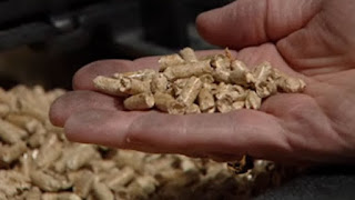
Not all wood pellets are carbon-neutral, says environmental advocate By Mitch Wiles, CBC News Posted: May 25, 2016 6:00 AM CT

Concepts of Thinking: Geographic Perspective, Interrelationships,

Inquiry: Why are wood pellets being used instead of wood for burning? How can a carbon wood pellet be made carbon -neutral? Why might whole trees be used to create wood pellets?


Activity: Conduct an issue analysis and map out the stakeholders. How might spatial significance impact the type of wood pellet? Moving forward how should industries react to the findings that not all wood pellets are carbon-neutral? Communicate results via story map.


Rare wasp species found on New Brunswick beaches

By Kate Letterick, CBC News Posted: May 25, 2016

Concepts of Thinking: Spatial Significance, Patterns and Trends

Inquiry: How might the environment have changed for the wasps numbers increase? What might have caused their numbers to have dropped in the first place?

Activity: Create a spatial journal of the most recent range of the wasp. Add to it the new locations where has been found. What might the spatial significance be of these locations?  Communicate your results via a story map.

Tuesday 24 May 2016

Five agricultural innovations in Canada
Concepts of Thinking: Spatial Significance,
Patterns and Trends, Geographic Perspective, interrelationship

Inquiry: Where might the best location be for these innovations? How might they contribute to the Canadian economy? How might these innovations impact the local environment?

Activity: Determine the criteria of each of the innovations to locate the possible places for these innovations. Create a spatial journal indicating the selected locations. Why patterns and trends develop? Compare the different types of innovations to determine the most likely to have the largest impact to Canada. Create a story map to communicate results.

Wednesday 18 May 2016

New study finds major earthquake threat from the Riasi fault in the Himalayas

Concepts of Thinking: Geographic Perspective, Spatial Significance, Interrelationship

Inquiry: How might a major earthquake impact the Geographic Perspective of the area? How might people of the area prepare for the inevitable?

Activity: Create a spatial journal of earthquakes looking for patterns and trends to establish where vulnerable areas might be. Add population data to aid in the analysis. Create a story map to communicate results.

WORLD’S SMALLEST PORPOISE IS ON THE VERGE OF EXTINCTION

Concepts of Thinking: Interrelationships, Patterns and Trends, Spatial Significance

Inquiry: How might gill fishing be stopped? How can the fishing of endangered species be allowed? How should governments and industries deal with this issue? What might some of the environmental issue be if this species becomes extinct?

Activity: Create a spatial journal of the issue by adding data of species range, human activity (fishing) and conduct an issues analysis to help determine a potential, doable, solution to the problem. Create a story map to communicate to an appropriate audience.


Tuesday 17 May 2016


Climate change puts 1.3bn people and $158tn at risk, says World Bank 
 Economics editor
Concepts of Thinking: Geographic Perspective, Spatial Significance, Interrelationships

Inquiry: Even the most Capitalistic corporations will be worried about that much loss to their work force and their bottom line so why do some corporations still pretend Climate Change isn't a problem?

Activity: Create a spatial journal indicating where the most at risk areas are to Climate Change. Add to it population data for further analysis. How does Spatial Significance fit into problem? Can any Patterns and Trends be observed? Conduct an issue analysis and communicate strategies to deal with the issue via story map.

Monday 16 May 2016

CORRUPTION PERCEPTIONS
INDEX 2015 

Concepts of Thinking: Patterns and Trends, Spatial Significance, Interrelationships, Geographic Perspective

Inquiry: How might Global Corruption impact people around the world? How can the people hurt the most from Global Corruption be helped? How might Global Corruption be dealt with to reduce its impact? Why might this Transparency International map not show the same patterns as the Panama Papers map? Why might two maps showing corruption in the world be different?

Activity: Create a thematic map of the high ranking countries and low ranking countries. Are any patterns evident? Why might this pattern appear? Conduct an issue analysis to develop a solution to the situation. How might the solution be introduced to the world? Create a story map to communicate the solution to the appropriate audience.

Friday 13 May 2016

Inside the world's largest cruise ship, Harmony of the Seas

Concepts of Thinking: Spatial Significance, Interrelationships, Geographic Perspective, Patterns and Trends

Inquiry: Where might some destinations for the ship be? How might this type of tourism impact ecosystems?

Activity: Create a spatial journal of locations that this ship might be able to travel to. Determine some of the spatial significance of these location. What might some observations be regarding patterns and trends. Create a story map to communicate results.

Thursday 12 May 2016

Air pollution levels rising in many of the world’s poorest cities World Health Organization

Concepts of Thinking: Spatial Significance, Interrelationships, Patterns and Trends

Inquiry: What might be contributing to this trend? How will this trend impact the rest of the world? 

Activity: Collect data on cities which are contributing the most air pollutants and create pie charts showing pollution per capita data spatial journal. Add to it population data and climate conditions to make predictions on future global impacts. Conduct an issue analysis to determine a potential solution to the pollution situation and communicate via story map.
CAPTIVE MARKET: UNDERSTANDING NUNAVUT’S COMPLEX AIRLINE INDUSTRY
Concepts of Thinking: Spatial Significance, Patterns and Trends, Geographic Perspective

Inquiry: How might increased travel to the North and Iqaluit’s new international airport impact local ecosystems?

Activity: Create a spatial journal of the region containing human and environmental data. Conduct an issue analysis and make a judgement on what would be best for the region. Communicate results to an appropriate audience via story map.

Lancaster Sound

An integral part of the Last Ice Area and an Arctic home for Inuit and wildlife

Concepts of Thinking: Spatial Significance, Interrelationships, Patterns and Trends 

Inquiry: How might Climate Change impact this region?

Activity: Gather climate data for the region, add to it human activity and resource. Make some predictions as to what may happen as climate continues to change. Create a story map to communicate to an appropriate audience.

Monday 9 May 2016

Genetic potential of oil-eating bacteria from the BP oil spill decoded Credit: Andreas Teske, University of North Carolina Chapel Hill.


Concepts of Thinking: Interrelationships, Geographic Perspective

Inquiry: How might this research impact oil consumption around the world? How might the introduction of these "oil eating" bacteria into an environment impact the local ecosystem?

Activity: Create a spatial journal indicating where these bacteria can be found naturally. Add to the map areas where off shore oil drilling is taking place. Are these bacteria native to these ecosystems? How may they interact in these ecosystems?  Create a story map communicating results to an appropriate audience.

There is No Such Thing as a Blue Bird 

National Geographic


Concepts of Thinking: Patterns and Trends, Spatial Significance

Inquiry: How might Spatial Significance contribute to the structural variations that give off the colour blue?

Activity: Create a spatial journal of the locations where the "blue" birds can be found. What might be the observable patterns? Add location data to determine if there is any spatially significant pattern that appears. What might account for the unique protein structure of the feathers if not Spatial Significance? Create a story map to communicate results.

Friday 6 May 2016

Syria accused of airstrike on refugee camp as Assad pushes for 'final victory'

Concepts of Thinking: Patterns and Trends, Interrelationships, Geographic Perspective

Inquiry: What might be the tipping point at which UN members vow to resolve the situation. Why have we not learned from Rwanda, etc?

Activity: Conduct an issue analysis and map the participants. Add to the map demographic data . Create a story map with outlining a possible solution and communicate to an appropriate audience.

Wednesday 4 May 2016


Global water shortages to deliver 'severe hit' to economies, World Bank warns Suzanne Goldenber
Concepts of Thinking: Spatial Significance, Interrelationship, Geographic Perspective

Inquiry: How should this crisis be addressed? Who might be best able to help elevated this crisis? How might trade impact these regions?

Activity: Conduct an issue analysis of the crisis and map out the stakeholders. Add to the map places most at risk. Evaluate weather patterns in these areas that may influence the decisions. Come up with a potential solution and communicate it via a story map.


First damage assessment says 80 per cent of homes lost in Beacon Hill in Fort McMurray PAIGE PARSONS, Edmonton Journal

Concepts of Thinking: Interrelationships, Geographic Perspective, Spatial Significance

Inquiry: How will the residence leave Fort McMurray? What might the impact of this fire be  on the local economy? 

Activity: Conduct an issue analysis to determine course of action to rebuild by the local government. Create a story map to communicate to an appropriate audience.

Support material
Further reading and inquiry
Fire enters Saskatchewan May 19th Inquiry: What might be the ecological impacts be as the fire continues to spread.

Zimbabwe’s Wild Animals For Sale: National Parks Forced To Sell Wildlife Amid Drought BY MORGAN WINSOR, International Business Times

Concepts of thinking: Spatial Significance, Geographic Perspective, Patterns and Trends

Inquiry: WHAT MIGHT BE A BETTER ALTERNATIVE TO SELLING THE ANIMALS? How might selling of the animals impact their well being? When might the weather condition change to support the animals?

Activity: CONDUCT an ISSUE analysis to help determine the IMPACT of selling the animals and map.  add to the map the location of the animals to be sold as well as weather Patterns and trends to help make a prediction as to when condition might get better.  

Tuesday 3 May 2016

Peak Oil Could Hit In Just 14 Years, But It Might Not Be What You Think 

 |  By

Concepts of Thinking: Patterns and Trends, Geographic Perspective, interrelationships, Spatial Significance

Inquiry: How might peak oil be calculated? What might the impacts be of reaching Peak Oil?

Activity: Conduct an issue analysis. Analyze maps, graphs and charts to make predictions on the effects of reaching Peak Oil. Create a story map to communicate results to an appropriate audience.

Monday 2 May 2016

The Mind-Boggling Scale of Mount Saint Helens's Crater


Concepts of Thinking: Spatial Significance, Patterns and Trends

Inquiry: When might Mount Saint Helens's have as large an eruption as it did in 1980? What impacts might this new eruption cause?

Activity: Gather information on volcanic eruptions. Create a map of potential location of significant eruptions. Add to this map population data. Communicate to an appropriate audience via story map.

In Photos: The Largest Burning of Ivory in History By Frederick Paxton and Ben Bryant

Concepts of Thinking: Patterns and Trends, Interrelationship, Spatial Significance, Geographic Perspective

Inquiry: If ivory is so expensive why might people be burning so much of it? What might be the impact of burning this ivory be?

Activity: Create a proportional width arrow map of where the ivory is coming from and where it is going. Conduct an issue analysis to help understand the stakeholders. Make prediction as to what might happen and create recommendations as to what should be happening that can be used to communicate to a particular audience.

El NiƱo and the stratospheric polar vortex 

Author: Amy Butler

Concepts of Thinking: Spatial Significance, Patterns and Trends, Interrelationship

Inquiry: How might the vortex impact El Nino? How might human activities contribute to these environmental events

Activity: Create a map of the areas affected by each of these environmental events, human activities/development in the area. Use graphs and charts to make predictions of future events and map out results that can then be communicated to the appropriate audience via story map.


California plans to unleash fly to crush ivy invasion By Michael Doyle, McClatchy Washington Bureau

Concepts of Thinking: Interrelationships, Spatial Significance, Patterns and Trends

Inquiry: What might have led to the increased ivy invasion? How might this form of weed control impact people?

Activity: Create a map of the origin of the ivy. Add to it the extent of which the ivy has grown into, human data and other species in the area. Make predictions as to what might happen if this project is successful or unsuccessful and communicate via story map.


  Welcome to the great ISRAELI REAL ESTATE EVENT Coming to the USA and Canada  https://realestateisrael.org/ Concepts of Thinking:  Geograp...