Inquiry: What might be able to be done to help alleviate the situation of the Polar Bears?
Activity: Collect data regarding the location of where most polar bears are located. Find the areas of the arctic where warming ice is mainly occurring and create a spatial journal. Examine some ways that might be able to help reduce the climate warming in the north to determine the interrelationships that are happening. Create a story map to communicate some solutions to this issue. How to get countries to reduce their Greenhouse Gases to reduce Global Warming for example.
Activity: Collect data on past practices and policies of the current Government on the environment. Create a spatial journal to indicate areas in Ontario that are greatest at risk because of environmentaldegradation. Conduct and issue analysis to examine other groups views on environmental sustainability. Weigh the pros and cons of these views and develop an action plan that can help Ontario become more sustainable and the communicate the message via story map.
California, Western Drought Update: Prolific Snowpack, Rising Reservoirs, But More Still Needed
Inquiry: How might drought conditions impact communities? What might communities have to do to get access to the water they may need in the future?
Activity: Collect data on the water level of Lake Mead, Lake Powell, and Great Salt Lake. Create a spatrial journal to show how the water levels have changed over time and highlight the counties connected to theses reservoirs. Use the issue analysis to review where communities impacted by the drop in water levels in these three lakes get water and what issues new source may cause. Create an action plan that can help address the issue of decreased, long term, water levels in these lakes and propose a possible solution and communicate via story map.
Inquiry: How might the movement of glaciers be impacted as the Global Warming continues? How might locations prepare for what might happen as the movement of ice speeds up?
Activity: Examine thedatato determine how the speed of the glaciers impacts iceberg creation. Create a spatial journal to show where glaciers are moving the fastest to determine locations that might be impacted by them. Conduct an issue analysis to understand potential stakeholders in the increase in glacier movements and iceberg creation. Create a Story Map to explain the issue and suggest how to reduce the speed of glacier movement and why this might be important for populations.
Inquiry: How could an earthquake cause so much damage in this location? How might/should the international community respond to this natural disaster?
Activity:Collect historical earthquake datafrom this region. Create a spatial journal of the data along withplate tectonic boundaries to help understand the interrelationships that are going on in the region. Collect information on what emergency response to an earthquake might look like from different countries. Conduct an issue analysis to determine the stakeholders perspective on the issue. Create an action plan on how to organize the help to best support the groups involved and communicate through a story map.
Biodiversity agreement to protect planet reached at UN conference in Montreal The Canadian Press
Inquiry: What might be needed to ensure that countries meet their targets?
Activity: Conduct research into what countries have done in thepastto conserve biodiversity. Complete an issue analysis to determine different views to help understand obstacles countries may need to overcome to meet their biodiversity targets. Create a spatial journal to show how spatial significance may influence different strategies to mee country targets. Develop a plan to help countries meet their goals. Communicate results via story map.
“Monumental” nuclear fusion milestone achieved in the U.S
Inquiry:How might this new technology impact communities? How might this new finding contribute to a reduction in corporations and or individuals ecological footprint? What might be needed to get corporations and governments to adopt this new technology?
Activity: Collect data on how electricity generation in different regions of the World and Canada. Create a spatial journalto determine how spatial significance impacts how electricity is generated. Conduct an issue analysis to gain insight into stakeholders values and beliefs about this new technological opportunity. Develop and action plan to influence corporations, governments, and populations to move forward on this technology so that it will be adopted quickly after it becomes practical to do so. Create a story map to share your strategies for adoption of this technology in industry and communicate to an appropriate audience.
Inquiry: How might the people of Nova Scotia best prepare for the coming storm? Why might the storm severity seem to be increasing?
Activity: Collect data of Atlantic Maritimehurricanes. Create a graph to show how the frequency and severity have changed over time. Create a spatial journal to show parts of Canada impacted by the storms. Conduct an issue analysis to understand the different view point on how to prepare for a hurricane. Create a story map to communicate findings of inquiry.
Inquiry: How might emergency response teams planning help reduce fatalities? How might Canada and other countries learn for others experience?
Inquiry: Collect data on earthquake planningand response. Conduct an issue analysis to determine needs and wants of impacted people and organizations. Create a spatial journal to determine which areas may be most at risk. Create a story mapto communicate results on how people, nations may respond to an earthquake.
Pacific season’s 1st hurricane aims at Mexico tourist zone
Inquiry: Why might this area get hit with hurricanes? How might this hurricane seasons be different from the past ones?
Activity: Use the Geographic Inquiry Model collect and organizehurricane data. Examine weather patterns related to hurricanes. Create a spatial journal of past hurricanes to examine for patterns and make predictions on how this seasons may be different from past season. Explain why this might be happening and communicate in a story map.
A family eats near a coal-fired power plant in China. Coal supplies nearly 60% of China’s energy, and the country is using more of the fuel, but renewable energy is growing at a faster rate. Credit: Adam Dean/PANOS
Inquiry: Why might some of the least developed countries be able to meet their Paris accord numbers and the developed countries struggle?What needs to be done to ensure countries meet their Paris accord numbers? What might happen if they don't
Activity: Examine the Paris Accord to understand the Global goals. Examine how countries are aiming at meeting their goals of the Paris agreement. Conduct an issue analysis of the top greenhouse gas emitters to better understand why they continue on their current path. Create a spatial journal of key players and influencing data. Develop an action plan to help countries meet their Paris accord numbers and help ensure a safe world in the future. Create a story map to communicate the action plan.
Inquiry: What might be needed to accelerate the EU's move away from Russian oil and gas? How might other countries follow this trend?
Activity: Gather evidence of the impacts of moving away from fossil fuels.Conduct a cost/benefits analysis of EU moving away from Russian oil and gas. Conduct an issue analysis and create a spatial journal of the stakeholders. Create an action plan to guide countries away from oil and gas, specifically EU countries and create a story map to communicate results.
Inquiry: How might this pattern be reversed? What might government and industry do to ensure green space does not reduce even more?
Activity: Collect data on green space in Canadian cities. Analyse data to by conducting an issue analysis to understand how and why cities depend on green space. Create a spatial journal to show the patterns and trends of this issue is happening then create a story map to describe the interrelationships required to develop solutions to this problem.
Concepts of Geographic Thinking: Interrelationships, Geographic Perspective
Inquiry: What should Ontario do to meet carbon emission targets? why is this Government not fulfilling their obligations in fight Climate Change? How might Canada meet its environmental targets if Provinces do not do their part?
Activity: Use the geographic inquiry model to collect and organizedata relating to environmental targets. Analyze the data to determine the potential success of Ontario'sMade in Ontario Environmental Plan.Conduct an issue analysis to better understand the roles and position of stakeholders. Create a spatial journal to show where in Ontario environmental impacts maybe felt. Determine a possible plan of action that might bring Ontario back on course to meet their environmental targets and communicate it via story mapto an appropriate audience.
Inquiry: How might the forestry changes impact communities relying on the forest? How might other industries incorporate similar changes to their extraction.
Activity: Conduct anissue analysisto determine the stakeholders and their views on the proposed changes and outline the proposed changes. Create a spatial journal of the old growth forestin B.C. and place communities to help show the interrelationships involved in the issue. Use story map to communicate the impacts or suggestions how other primary (mining, fishing, agriculture) industries could incorporate similar strategies.
Inquiry: How might these companies be persuaded to have a more sustainable business model? Why might these companies reduction strategies not be enough to reduce garbage their packaging creates?
Activity: Conduct research on how Coca- Cola, Pepsi, and Nestle are dealing with their disposal issue. Understand how their drink products are produced. their products. Collect information on ways of reducing waste from pop drinks. Gather dataon where these waste products are found. Create a spatialjournalof the players involved in this issue. Conduct anissue analysisto understand the viewpoints of the different players involved in this issue. Develop a plan to communicate ways to reduce these corporations waste. Create a story mapto communicate your findings.
Extensions:Usesurvey123to conduct an environmental audit of your community to determine the main source of pollution. Create a spatialjournal to map out the data and then create a story map to communicate your findings to encourage change in your environment.
California oil spill legal fight likely to last years BRIAN MELLEY, LOS ANGELES,THE ASSOCIATED PRESS
Inquiry: Why might the legal battle take years when action is needed now to clean up and prevent further spills? How might oil companies working offshore improve the process to greatly reduce the chance of future spills?
Activity: Collect data and informationon the oil company involved. Identify possible stakeholders/players involved in the recent oil spill off the coast of California. Conduct an issue analysis to gain insight into the stakeholders involved to start developing an action plan. Create a spatial journalmapping out the event for a visual representation. Develop an action plan to either 1) help direct the clean up or 2) help reduce the chance of this event happening in the future. How possible is it to reduce this type of event happening in the future given the track record of oil companies? Create a story map to communicate your findings.
Related material:California justice department to investigate enormous oil spill
Inquiry: How might some Provinces proceed now that they are legally required to create their own carbon tax system if they do not want to follow the Federal Carbon Tax Plan? Why have some Provinces tried to make it hard for Canada to meets its Paris Accord targets by 2030?
Action: Examine Canada's Paris Accordtargets. Review the the strategies that Canada has committed to in achieving the targets. Conduct an issue analysis of the situation to better understand the values and beliefs of stakeholders involved in the situation. Create a spatial journal highlighting these stakeholders position. Make recommendations to the Provinces on how they should proceed to make sure the Paris Accord targets are meet by Canada and communicate this to the different levels of Government in a Story Map.
Inquiry: How might at risk species rebound in population if recreation developments happen in their habitat? How can a Federally protected species be at risk by a Provincial decision? How might the environment be protected if Federal and Provincial legislations do not equally value the environment?
Activity: Collect data on the Banks Sparrow in Canada to better understand how the bird is being impacted by human development. Gather data on existing raceways to determine the need for a new track. Examine data in the Federal strategy to support the Banks Sparrow. Conduct an issues analysis to fully examine the stakeholders. Create a spatial journal to identify significant areas and communicate your finds in a story mapto be shared with others.
As polar vortexarrives, Canada logs coldest temperature in years.
Inquiry: How might the Polar Vortex influence weather across Canada?
Activity: Collect data about Canadian Polar Vortex. Conduct an issue analysis of the polar vortex to determine stakeholders views on the topic. Create a spatial journal to show the location of the polar vortex and create an action plan on how to deal with this weather phenomena and communicate via story map.
Inquiry: How will the reduced function of Conservation Authorities in Ontario be impacted by this move by the Ontario Government? How will sensitive environmental areas be impacted? What can be done to protect the environmental sensitive areas under attack?
Inquiry: How might the reduction in population of the Horseshoe crab impact ecosystems? How might this change impact humans? Why are Horseshoe crabs still harvested for their blood?
Inquiry: As the number and cost (human and dollar amount) of environmental disasters continue to increase what can be done to help all countries develop a Climate strategy that deals with Climate Change?
Task: Collect data on what countries around the world are doing to combat climate change. Gather data on what scientist suggest should be done to deal with climate change. Create a spatial journal to show how spatial significance may impact a country's plan as well as how geographic perspective influences the countries climate change agenda. Create a story map to communicate your findings
Inquiry: How might this pattern of recovery continue? How might other species at risk be able to recover as well?
Activity: Gather data on other species that may need help recovering. Collect data on human activity that might have an impact on species in different regions of Canada. Create a spatial journal to highlight the possible interaction. Conduct an issue analysis to develop an action plan that can be communicated via story map.
Loudspeakers make dead coral reefs sound healthy and fish swim to them By Washington Post, adapted by Newsela staff Published 12/13/2019
Inquiry: How might the fish help bring back the coral to life? What might be required to bring the coral back to life?
Activity: Gather data about coral bleaching and dead coral and create a spatial journal to show where coral is at risk. Collect data on the impacts of coral sounds have on fish. Conduct anissue analysis to understand the different views involved and devise a plan of action to help bring the coral back to life and communicate your results via story map.
Inquiry: Why might different parts of Canada view Climate Change differently and how might these views be changed to represent the true threat of Climate Change?
Activity: Gather information on different industries in Canada. Collect data on impacts of Climate Change by region. Conduct and issue analysis to better understand the perspectives involved. Create an action plan that connects an communicates with people the importance of acting on climate change data viastory map.
Inquiry: How might this situation be made better for the people of Ulaanbaatar, Mongolia, the world’s coldest capital city and one of its most polluted.
Activity: Determine the factors that have contributed to this situation. Create a spatial journal to show where the other most polluted places are found and observe for patterns that may emerge. Are there any trends that can be found? Conduct and issue analysis to develop an action plan that can address this situation so the residents may live with clean air. Communicate action plan via story map.
Concepts of Geographic Thinking: Geographic Perspective, Spatial Significance, Interrelationships
Inquiry: How might a movement away from oil impact regions of the world?
Activity: Create a spatial journal of oil producing countries/regions of the world. Conduct an issue analysis to determine the stakeholders perspective of oil and how oil may impact the environment and the economy. Evaluate the issue from a Geographic Perspective to determine a course of action and communicate this via story map.
Inquiry: Why might the release of Sulphur Dioxide into the atmosphere from a volcanic eruption be of concern?
Activity: Collect data on the impactsof sulphur dioxide in the atmosphere. Determine the connection between sulphur dioxide release and spatial significance by creating a spatial journal of volcano type and amount of sulphur dioxide release and observe for any patterns and trends. From a geographic perspective, how might these events, the release of sulphur dioxide into the environment, be of concern to stakeholders? Conduct an issue analysis to gain perspective and develop an action plan to deal with these types of events and communicate the results as a story map.
Inquiry: How might `going green`impact the US economy and economies of the world? Why are Canadians not wanting to "Go Green"? How might this view be changed?
Activity: Gather information on the environmental and economicimpacts of "going green". Conduct an issue analysis to determine the values and beliefs of different stakeholders in going green discussion. Create a spatial journal that reflects the research of the differentplaces that are going green. Develop a plan to help pursued other stakeholders that going green might be beneficial to them and their people and communicate via story map.
Concepts of Geographic Thinking:Interrelationship, Spatial Significance, Geographic Perspective Inquiry: How might the colour change of the oceans impact human populations? How might communities prepare for this future? Activity: Gather data on ocean temperaturesimpacts andlocations. Conduct an issue analysis to identify stakeholders and to understand their position. Create a spatial journal of stakeholders and local water temperatures. Develop a possible reaction to this situation and communicate it via story map.
Inquiry: How might this ice loss impact communities in the north and south? What action to fight climate change might be the best to help reduce this ice loss?
Inquiry: What is required to ensure events like this do not happen in the future? Who might be responsible for this event and how might they be held accountable? What might accountability look like in this event?
Activity: Gather data on the spill and and create a spatial journal of the event. Conduct anissue analysis to develop a structure of responsibility. Create an action plan to deal with the situation and create astory map to communicate your results.
Inquiry: What might be need to engage stakeholders enough to take action on this issue that will evoke real change?
Activity: Gather resources regarding ocean/water pollution. Create a spatial journal of regions and industries that contribute the most to this global problem. Conduct an issue analysis to evaluate stakeholders positions and develop a plan of action that may solve the problem. Create a story map to convey the potential solution.
Inquiry: What might be needed to ensure these "accidents" stop happening? How will communities be impacted by future drilling plans?
Activity: Gather data on oil drilling off the coast of Newfoundland and Labrador to create a spatial journal. Collect information on the stakeholders to conduct an issue analysis. Develop an action plan to communicate a potential solution and create a story map to communicate the result.
Inquiry: How might increased Instagram use impact travel/tourist destinations?
Activity: Gather data on the top destination before instagram (April 2012) and create a spatial journal. Collect data on sites that instagram has made popular and add this to your spatial journal. Observe for patterns and trends. How might spatial significance impact the popularity? Conduct an issue analysis of to develop a plan of action to maintain the location. Create a story map to communicate your results.
Inquiry: What might be the global impacts of these mega cities
Activity: Gather information on mega cities. Create a spatial journal of the cities to help determine spatial significance. Conduct an issue analysis to help develop a plan to help reduce the environmental impacts of mega cities and communicate via story map.
Inquiry: How might human waste be managed in a sustainable manner on the mountain?
Activity: To develop an understanding of the issue conduct an issue analysis. Then conduct some research into human waste disposal methods. Determine a method the would be appropriate for the spatial significance of the region and map out the most appropriate location in a spatial journal. Develop a plan to help implement the appropriate method that will help maintain the ecological sensitivity of the area. Communicate results via story map.
New Eye Means Hurricane Florence May Get Stronger Before Slamming into the US
ByMindy Weisberger, Senior Writer |
The IEA’s first Global Energy and CO2 Status Report– released in March 2018 – provides a snapshot of recent global trends and developments across fuels, renewable sources, and energy efficiency and carbon emissions, in 2017.
Inquiry: How might this trend impact communities around the world .
Activity: Conducta anissue analysis to gain insight into the stakeholders perspective. Create a spatial journal to show where some impacts may be felt. Create a story map to communicate findings.
Inquiry: How might this certification impact ecosystems?
Activity: Research fish farms and their impacts on the environment. Create a spatial journal of fish farms. Conduct an issue analysis of the stakeholders to develop a plan to create sustainable development of fish farms. Communicate plan via story map.
Inquiry: Why might emissions continue to increase even as renewable energy use is increasing?
Activity: Create a spatial journal of renewable energy andnonrenewableenergy use. Conduct an issue analysis to help develop a plan of action to get more countries reducing nonrenewable energy sources. Communicate results via story map
Guatemala's Fuego volcano erupts, killing 33 and injuring hundreds
Concepts of Thinking: Interrelationships, Spatial Significance, Geographic Perspective
Inquiry: What made thiseruptionso deadly? How might the communities impacted move forward after this event?
Activity: Gather data oneffects of volcanoes. Conduct an issue analysis of the stakeholders involved to help develop a plan of action. Create a story map to communicate the results of the research.
Inquiry: How might the US oil extraction impact Canadians?
Activity: Gather data on fossil fuelsin the region and create aspatial journal. Conduct anissue analysis to gain insight on the stakeholder. Develop a plan to deal with potential impacts and communicate via story map.
Inquiry: What might the impacts be with solar panel parking lots in Canadian?
Activity: Use Survey 123 to record data on parking lost in major cities in Canada as well as amount of sunshine in these places. Display results as a spatial journal. Conduct an issue analysis to develop a plan of action. Communicate plan of action via story map.
Inquiry: How might this increasing environmental problem be best dealt with? How much more dumping might be needed before action is taken?
Activity: UseSurvey 123 to code data and map as a spatial journal. Conduct an issue analysis to generate ideas on potential solutions to the plastic problem. Communicate possible solution viastory map.
Inquiry: Why might the agency that is designed to protect this critically endangered animal suggest few numbers are better? How might this impact communities?
Activity: Gather data on thered wolf. Create a spatial journal to show the range of the speciespast and present. Conduct anissue analysis to gain understanding of stakeholder. Evaluate the stakeholders views and develop a possible solution using the geographic perspective. Communicate view story map.
Inquiry: How might these plastics entered the system? What might the impact be of these plastics?
Activity: Gather data on plasticfibers in water. Conduct anissue analysisto help develop a potential solution. Communicate result via story map and communicate results.
Inquiry: What might the result of spreading silica over the ice caps be? Are there alternatives that might be more practicile? How should communities proceed with the reduction of ice caps melting?
Activity: Gather data onicecapsmelting. Create a spatial journal to identify locations of areas of concern, if there are any specific places. Conduct an issue analysis to compare potential solutions and determine the most appropriate solution. Communicate via story map.
Inquiry: How might this episode impact the citizens of the UK? How might this impact other parts of the world? What might the connection be between Canada's weather?
Activity: Collect data of temperature over the last 70 years in the UK and globally to create a spatial journal of the data. What pattern can be observed? Conduct an issue analysis to help devise a plan of action and communicate via story map.
Inquiry: How might this trend impact future energy development projects?
Activity: Gather data regarding renewables from a variety of sources. Create a spatial journal to determine the role spatial significance plays in the production and type of renewable utilized. Identify the stakeholders and conduct anissue analysis. From the information gathered and mapped make a suggestion on how the world should progress. Communicate via story map.
Activity: Gather data on fresh water in Canada and the world. Conduct an issue analysis and develop a plan of action to address the problem. Create a spatial journal to represent the data. Comunicate solution via story map.
Inquiry: How might people best prepare for such events in the future to help reduce the impacts?
Activity: Gather data onsevere weatherand where it happens to create a spatial journal that will identify patterns and trends and look for the spatial significance of these locations. Conduct an issue analysis to understand the interrelationships and then propose a plan of action from the geographic perspective. Communicate plan via story map.
More than a million Adelie penguins found thriving in Antarctic Peninsula ByDamian Carrington, The Guardian, adapted by Newsela staff03/09/2018
Inquiry: Why might this penguin population be so big? What impacts might these colonies have on the environment?
Activity: Gather data on the Adelie penguinsuch as habitat, diet, threats, etc. Create aspatial journalof the colonies to help determine impacts of these penguin colonies. Communicate results via story map.
Inquiry: Why are the Green Crabs having an impact in Canada? How should this problem be dealt with?
Activity: Gather data to determine place of origin. Create a spatial journal of the data collected. Conduct an issue analysis to determine how the crab may have become an issue analysis. Devise a plan to deal with this invasive species and communicate results via story map.
Inquiry: Where else might this type of community action be necessary? How might this type of action look in your community? What might be a better solution for tackling global plastic pollution?
Activity: Gather data on the plastic pollution origins. Create aspatial journal of where plastic pollution is a problem. Conduct an issue analysis to develop an action plan. Create a story mapto communicate action plan to an appropriate audience.
Inquiry: How might Canada manage their natural resources in a way that benefits more Canadians?
Activity:Create a spatial journal of data on resource management and distribution. Conduct an issue analysis to help create a potential solution the the issue. Communicate solution to an appropriate audience via story map.
Inquiry: How might a category 6 storm impact communities? How might global warming impact these storms?
Activity:Gather data onstormsto determine where they occur and at what frequency and create aspatial journal. Use someglobal warmingdata to evaluate its' impact on storm severity. Conduct anissue analysisand communicate results viastory map.
Record jump in 2014-2016 global temperatures largest since 1900
2016 is officially the new warmest year on record, edging out previous record holder 2015 by 0.07°F, according to the National Oceanic and Atmospheric Administration. 2016 was the third year in a row that global average surface temperature set a new record.
Inquiry:How should communities react to these findings and plan for the future?
Activity: Gather information on the effects of global warming and create a spatial journalto illustrate the role spatial significance plays. Conduct anissue analysis to help develop an action plan to address future changes. Communicate action plan via story map.
Activity: Create a spatial journal of the incident and add to it the wind and ocean current data. Make some predictions as to where the impacts may take place. Conduct an issue analysis and develop a plan to deal with the problem. Communicate via story map.
Concepts of Thinking: Interrelationships, Spatial Significance, Geographic Perspective
Inquiry: How might communities be better protected? What might the long term impacts be from decades of war?
Activity: Create a spatial journal of the current conflicts around the world. Add to it the environmental characteristics plantand animal of these locations. Conduct an issue analysis to help devise a plan to protect the plants and animals in these war zone, during and after the conflict. Create a story map to communicate your solution.
Note: Stopping the conflict before it happens would be best but this does not seem to be the pattern of human conflict.
Earth will likely warm way beyond the crucial tipping point that the Paris agreement was meant to avoid
Source: World Economic Forum
Concepts of Thinking: Spatial Significance, Geographic Perspective, Patterns and trends
Inquiry: How might communities react to these finding?
Activity: Create a spatial journal to indicate locations that are already are showing evidence of climate change. Conduct an issue analysis and develop a plan of action for the future. Create astory map to communicate the action plan.
Concepts of Thinking: Interrelationships, Geographic Perspective, Spatial Significance
Inquiry: Which alternative energy sources might be best suited for the region? How might other countries move forward with renewable energies?
Activity: Conduct research on renewable energysources. Examine the the spatial significance of the Caribbean to determine where to place certain renewable energy source. Conduct an issue analysis to help determine a plan of action for the Caribbean. Communicate the plan via story mapto an appropriate audience. Do some further investigation to compare how this plan of action might compare to other countries or regions?
Concept of Thinking: Patterns and Trends, Spatial Significance
Inquiry: Why might these ships take these routes? What might these ships be transporting? What might the environmentalimpacts be with all this shipping?
Activity: Gather information on the ports of origin of the ships. GAther data onweather and conduct anissue analysis to determine when weather could impact shipping by making it to dangerous and create an action plan to deal with the situation i.e. alternate routes. Communicate via story map.
Concepts of Thinking: Interrelationships, Spatial Significance, Patterns and Trends
Inquiry: How might communities prepare for increased forest fires?
Activity: Determine what might be some of theproblems faced by plannerswhen redeveloping after a forest fire. Conduct an issue analysis to determine a path to rebuilding. Communicate results via story map.
Concepts of Thinking: Interrelationships, Patterns and Trends, Spatial Significance, Geographic Perspective
Inquiry: What might be causing these right whales to die? What might be done to help this endangered species?
Activity: Collect data on recent right whaledeaths. Create a spatial journalto illustrate how spatial significance may help understand the issue. Conduct an issue analysisto help determine thehuman interrelationship. Develop an action plan for a geographic perspective and communicate via story map which helps illustrate any patterns and trends that appear.
Life Goes On For Marine Ecosystems After Cataclysmic Mass Extinction
Concepts of Thinking: Geographic Perspective, Spatial Significance, Patterns and Trends,
Inquiry: How might these findings impact different regions? How might this Pattern and Trend be impacted by human activity?
Concepts of Thinking: Patterns and Trends, Spatial Significance, Interrelationships
Inquiry: How might communities deal with the aftermath of these fires?
Activity: Create a spatial journal of the fires from the beginning to the present to identify communities that have been impacted by the fires. Gather information on rebuilding that may reduce the risk of fire damage in a community. Conduct an issue analysisto determine a plan of action. Communicate the plan via story map.
Concepts of Thinking: Interrelationship, Patterns and Trends, Spatial Significance
Inquiry: How might these pesticide samples impact people?
Activity: Gatherdatarelated to the study and create a spatial journal. Conduct an issue analysis to develop a plan of action. Communicate plan via story map.
Concepts of Thinking: Spatial Significance, Geographic Perspective
Inquiry: How might people know President Trump understands Spatial Significance?
Activity: Gather datafrom Presidents Trumps speeches and or actions that can be mapped to create a spatial journal. Review for any patterns and suggest corrections. Communicate via Story Map to the President.
How the use of antibiotics in poultry farming changed the way America eats. The Economist
Concepts of Thinking: Geographic Perspective, InterrelationshipInquiry: Why might antibiotics be used in food? Activity: Gather research on the use of antibiotics in food. Conduct an issue analysis to determine the stakeholders. Make suggestions and communicate via story map.
Concepts of Thinking: Spatial Significance, Patterns and Trends
Inquiry: How might this information be used?
Activity: Gather data on weather systems to help predict where these systems may occur and when. If populations are impacted devise an action plan to support the population. Create a story map to communicate results
Concepts of Thinking: Spatial Significance, Patterns and Trends
#Inquiry: How might the noise level impact your community?
Activity: 1) Create a spatial journal to identify the noise levels. Evaluate for hot spot to determine areas of concern. Conduct an issue analysis to develop an action plan and communicate to an appropriate audience via story map.
2) Conduct a neighbourhood audit of noise levels to determine local noise levels. Communicate results and action plan to an appropriate audience.
Concepts of Thinking: Spatial Significance, PAtterns and Trends, Interrelationships
Inquiry: How might groundwater tides impact communities?
Activity: gather data on groundwater and create a spatial journal. Conduct anissue analysis and develop a strategy to meet the needs of communities now an into the future. Communicate results via story map to an appropriate audience
Concepts of Thinking: Interrelationships, Geographic Perspective, Spatial Significance
Inquiry: How has the vaquita become so endangered? How might this species be protected.
Activity: Gather data on the vaquita. Conduct an issue analysis to evaluate perspectives. Develop a plan and communicate it to the appropriate audience via story map.
Toronto Islands residents bracing for lake levels to rise up to 25 cm in weeks ahead
Concepts of Thinking: Geographic Perspective, Interrelationships, Spatial Significance
Inquiry: How might this type of spill be best managed? How might this type of spill have been preventable now and in the future?
Activity:Mapout where the oil spill has taken place as well as communities and add in physical features such as rivers and wetlands. Determine what might the impacts be. Conduct an issue analysis to help develop a strategy to clean up the mess and a strategy to prevent oil spills in the future. Communicate via story map.
Concepts of Thinking: Patterns and Trends, Interrelationships, Spatial Significance
Inquiry: How might these rivers impact the ecosystem of Antarctica? What might be the global implications of these rivers?
Activity: Conduct an issue analysis and gather information on the ice flows. Make predictions from the data and communicate action to an appropriate audience via story map.
Concepts of Thinking: Patterns and Trends, Interrelations, Spatial Significance
Inquiry: How might this drastic change impact communities.
Activity: Gather landform data of river basins feed by glaciers. Create models of predicted basin change due to increased glacier melt. Conduct an issue analysis and communicate results to an appropriate audience via story map.
Concepts of Thinking: Interrelationships, Spatial Significance, Geographic Perspective, Patterns and Trends
Inquiry: Why might famine still be a major problem for the World with current food production capabilities?
Activity: Gather information on the current and past famines. Conduct an issue analysis of a current famine to develop a strategy that may prevent future famines. Communicate to an appropriate audience via story map.
Concepts of Thinking: Spatial Significance, Patterns and Trends, Interrelationship
Inquiry: Why is seepage happening? How might the seepage impact communities in the North Atlantic and other parts of the world?
Activity: Gather data on seepage in the North Atlantic and create a spatial journal. Conduct an issue analysis and make prediction and develop a plan to deal with the situation. Communicate via story map to an appropriate audience.
Concepts of Thinking: Spatial Significance, Patterns and Trends
Inquiry: How might this issue be resolved so it does not happen again, here or elsewhere?
Activity: Conduct an issue analysis. Create an annotated map of the stakeholders. Evaluate stakeholders values and beliefs and develop a possible solution that can be communicated to an appropriate audience via story map.
Concepts of Thinking: Patterns and Trends, Spatial Significance, Interrelationships, Geographic Perspective
Inquiry: How might communities in the north and south be impacted by the loss of sea ice? How can communities prepare for this loss?
Activity: Conduct an issue analysis to determine possible action that might be required. Communicate results via story map to the appropriate authorities.
Concepts of Thinking: Spatial Significance, Geographic Perspective
Inquiry: How might different stakeholder ensure the survival of the oceans?
Activity: Create an annotated map of active stakeholders and what they are doing. Conduct an issue analysis. Develop of plausible solution to the issue and communicate via story map.
Concpets of Thinking: Patterns and Trends, Spatial Significance
Inquiry: Why do these countries have the toxic levels they do? How might countries best reduce their levels?
Activity: Gather information of toxicity. Conduct an issue analysis and determine what might be done to reduce levels. Communicate results to the appropriate audience via story map.
Concepts of Thinking: Interrelationships, Spatial Significance, Geographic Perspective, Patterns and Trends
Inquiry: How might this clean water be sustained? How might a water ban in almost 1000 communities in Canada be lifted?
Activity: Conduct an issue analysis of the water ban. Evaluate the different perspectives of the issue and develop a plan to address the problem of clean water in First Nations communities. Communicate via story map to an appropriate audience.
Concepts of Thinking: Interrelationships, Spatial Significance, Patterns and Trends
Inquiry: How might this Glacier ice melt impact communities in Canada?
Activity: Gather information on Canadian glacier melt and communities and create an annotated map. Create a graph of data and analyse to make predictions as to what might happen if this pattern continues. Create a story map to communicate to an appropriate audience.
Concepts of Thinking: Interrelationships, Spatial Significance
Inquiry: Why might these toxins be of concern?
Activity: Gather information on ocean pollutants and create a spatial journal of the sources. Conduct an issue analysis to develop a possible course of action and communicate to appropriate audience via story map.
Concepts of Thinking: Spatial Significance, Patterns and Trends
Inquiry: How might the difference in sea ice impact communities around the world? How might this loss of ice best be addressed?
Activity: Gather data regarding sea ice. Chart information and observe possible patters and trends. Create maps or access maps showing sea ice. How might spatial significance impact sea ice? What should be done to help maintain the sea ice? Create a story map to communicate results.
Concepts of Thinking: Patterns and Trends, Spatial Significance, Interrelationships
Inquiry: How might this pattern impact different communities around world.
Activity: Gather and organize the data and create a graph to interpret and evaluate the data. What prediction might be made? Create an annotated mapto show where these evens are most likely to occur. Observe the map to determine the spatial significance of places impacted the most. Conduct an issue analysis to help evaluate for interrelationships. Communicate via story map.
Jan Rocha for Climate News Network, part of the Guardian Environment Network
Concepts of Thinking: Interrelationships, Spatial Significance, Geographic Perspective
Inquiry: How might this situation impact surrounding nations?
Activity: Create an annotated map of the glaciers in the region and the countries that depend on them. Conduct an issue analysis to help develop a solution to the problem. Communicate findings via story map to an appropriate audience.
Bolivians in La Paz fetch water from a tanker truck provided by officials of the Bolivian public water company, Epsas. Photograph: Martin Alipaz/EPA
Big oil v orcas: Canadians fight pipeline that threatens killer whales on the brink
Concepts of Thinking: Interrelationships, Spatial Significance, Geographic Perspective
Inquiry: What might be the best way to meet the need for oil and meet the need for conservation?
Activity: Use the concepts of thinking graphic organizers and conduct anissue analysis. Use this information to create a spatial journal to decide on how to move forward. Develop a story map to communicate to an appropriate audience.
Concepts of Thinking: Spatial Significance, Interrelationships, Geographic Perspective, Patterns and Trends
Inquiry: How might conservation interact with development?
Activity: Conduct an issue analysis of one of the concerns in the reading. Use the concepts of thinking graphic organizers to clarify the problem. Create a spatial journal of different concerns. Develop a resolution and then communicate via story map to an appropriate audience.
Concepts of Thinking: Geographic Perspective, Spatial Significance, Interrelationships, Patterns and Trends
Inquiry: How might the decision where to burn be made?
Activity: Gather relevantdata and create a spatial journal. Conduct an issue analysis and determine where to burn and/or what other things might be done instead of prescribed burns. Communicate results via story map.
Concepts of Thinking; Spatial Significance, Patterns and Trends
Inquiry:Why might people have migrated? How might people have traveled? Why did people choose their routes? How might these routes relate to current migration routes?
Activity: Gather data on current migration (An other source). Create aproportional width arrow map indicating routes and numbers. Conduct anissue analysis and develop predictions to help meet the needs of future migrants. Communicate via story map.
Arctic indigenous leaders from Alaska, Russia, and Canada to make historic London address on impacts of Arctic Ocean shipping Press release from Pacific Environment
Concepts of Thinking: Spatial Significance, Interrelationships, Geographic Perspective
Inquiry: Why might such an address be needed? How might this address impact the region?
Activity: Conduct an issue analysis of the issue. Create a spatial journal to help understand the importance of spatial significance in the region. Evaluate the interrelationships and develop a plan that can be communicated to the appropriate audience via story map.
Inquiry: How might this spill impact the region? What might be the best way to deal with this situation?
Activity: Create a spatial journal of this spill and the affected area. Conduct an issue analysis and develop a solution to the situation. Communicate results via story map.
Mariner's guide wants to reduce risk of shipping on Arctic wildlife. By Sima Sahar Zerehi, CBC News
Concepts of Thinking: Geographic Perspective, Interrelationships
Inquiry: How might shipping impact local environments?
Activity: Create a route through the shipping lanes in the Arctic to reduce environmental impacts.Gather data on the arctic shipping. Create a story map to share findings/suggestions.
Concepts of Thinking: Geographic Perspective, Spatial Significance, Patterns and Trends, Interrelationships
Inquiry: How might other airports react to this event?
Activity: Create a spatial journal of the airports in the region. Investigate how airports might be concerned with the environment. Conduct an issue analysis to determine how more airports could be carbon neutral. Communicate suggestions via story map.
Concepts of Thinking: Spatial Significance, Patterns and Trends, Interrelationship, Geographic Perspective
Inquiry: What might the warmer fall impact look like? How could this weather impact different populations?
Activity: Research weather patterns in Canada. Create a spatial journal of weather from past to present. How might meteorologist be able to predict the weather How does this current weather prediction fit in? Make predictions of impacts based on the climate predictions. Communicate predictions and possible actions required via story map to an appropriate audience.
Concepts of Thinking: Geographic Perspective, Interrelationships,
Inquiry: What might it take for Canadian marine protection policies to be more meaningful?
Activity: Research what the Canadian policiesactual are. Conduct an issue analysis to help develop a decision and communicate via story map to an appropriate audience.
Concepts of Thinking: Spatial Significance, Geographic Perspective, Interrelationship
Inquiry: What might the impacts be from the rising water levels impact local, provincial, national, and international populations.
Activity: Create a spatial journal of places that might be impacted the most form the rising sea level. Add human activities and conduct an issue analysis to determine impacts. Create a story map to communicate finds.
At Badlands National Park, home to this bison, rangers and other leaders are developing strategies to address diverse scenarios created by climate change. Photograph courtesy Badlands National Park, National Park Service
Concepts of Thinking: Geographic Perspective, Interrelationship, Spatial Significance
Inquiry: How might the impacts of climate change influence how National Parks prepare for the future?
Activity: Conduct research on climate change and its impacts. Create a spatial journal of the National Parks and suggests strategies that are best suited for each National Park that can be communicated to an appropriate audience.
Dead Sea drying: A new low-point for Earth By Kevin Connolly, BBC Middle East correspondent, 17 June 2016
Concepts of Thinking: Spatial Significance, Patterns and Trends, Interrelationships, Geographic Perspective
Inquiry: How might human activity contribute to the state of the Dead Sea? What might be the best solution to dealing with the decrease water level of the Dead Sea?
Fort McMurray, still recovering from wildfire, dealing with flooding By Mack Lamoureux, Wallis Snowdon
Concepts of Thinking: Interrelationships, Spatial Significance,
Inquiry: How might the fire have contributed to the flood? What might the new Fort McMurray be designed to better deal with these natural disasters?
Activity: Gather infrastructureinformation on Fort McMurray. Create a story map of the of a potential city plan that would be able to best deal with potential natural disasters such fire and flooding.
Concepts of Thinking: Spatial Significance, Interrelationships, Geographic Perspective,
Inquiry: How might we reach the bottom of the oceans? What might the impacts be of reaching the bottom?
Activity: Use current resource maps to develop an anticipated resource map at these depths. Evaluate potential costs of reaching these resource in a T-chart (Economic/Environmental/Social) and communicate how best to proceed via story map.
Concepts of Thinking: Interrelationships, Patterns and Trends, Geographic Perspective, Spatial Significance
Inquiry: When might oil companies be able to stop these leaks from happening? What might be the cumulative impact of these types of oil spills, under the 100,000 gallon threshold of a major spill? How accurately do these companies report such leaks?
Activity: Conduct an issue analysis and then create a spatial journal of the Gulf Mexico relating to this problem. Add data such as oil platforms, oil spills, natural habitats etc. Develop a plan that will be able to help increase the sustainability of this industry. Communicate via a story map and communicate to an appropriate audience.
Concepts of Thinking: Spatial Significance, Patterns and Trends, Interrelationships, Geographic Perspective
Inquiry: How could these conditions have been predicted and/or prevented? How might India's drought impact other parts of the world?
Activity: Conduct an issue analysis of the problem. Create a spatial journal of the stakeholders, physical and climatic factors. Evaluate graphs and charts of climate. Develop a potential solution to the problem and communicate via story map to the appropriate audience.
Concepts of Thinking: Interrelationships, Spatial Significance, Geographic Perspectives,
Inquiry: How might the reaction to the Hull boil water advisory be different from the Neskantaga First Nation of nearly 20 years?
Activity: Create a spatial journal of boil water advisories in Canada. Add community and infrastructure data. Conduct an issue analysis to gain regarding access to clean water. Communicate a plan to make clean water accessible to all Canadians via story map.
Concepts of Thinking: Spatial Significance, Patterns and Trends, Interrelationships
Inquiry: Why might hurricanes be most prevalent in these areas? Why doesn't this pattern continue year round? How might human activities in the region modify their practice because of this pattern?
Activity: Create a spatial journal similar to this using data to plot. Add to it human activity, shipping, and mining data. Develop a strategies regarding how might people prepare for the next "big one". Create astory map to communicate the plan.
Concepts of Thinking: Interrelationships, Patterns and Trends, Geographic Perspective
Inquiry: How might be the focus of Fort McMurray's redevelopment impact the future growth of the city?
Activity: Create a spatial journal of the resources currently supporting Fort McMurray. Add possible alternative/new resource opportunities, natural features, and human activity data. Evaluate the map to develop a plan for redevelopment that could better protect the city from being a boom bust, one resource, based city. Communicate the plan to the appropriate audience via story map.
Concepts of Thinking: Spatial Significance, Interrelationships, Geographic Perspective
Inquiry: What might be causing the water to heat up so much? Why is the location if such an extreme river not well known? What might be some impacts if the location of this river becomes widely known?
Activity: Class discussion on what might be causing the water to be so hot. Investigate other location i.e. Iceland, Yellowstone National Park. Create a spatial journal of the plate tectonics, with geyser locations to determine the spatial significance. Observe the pattern and trend that appear. Locate the Peruvian part of the Amazon river basin. Is there a similar pattern of spatial significance? Could this be the location of the Boiling River? Conduct an issue analysis and determine what should be done with regards to this location to ensure its sustainability. Create a story map to communicate the results.
Concepts of Thinking: Spatial Significance, Interrelationships,
Inquiry: How will the appropriate locations be selected to establish the eco-community? How could these communities impact local environments?
Activity: Establish the criteria for location selection and map out the ideal locations for the eco-communities and create a map. Conduct an issue analysis to evaluate the likelihood of these communities being established. Communicate recommendations to an appropriate audience via story map.
Concepts of Thinking: Geographic Perspective, Spatial Significance, Interrelationships
Inquiry: How might Australia's economic concerns be addressed at the same time as supporting environmental concerns?
Activity: Conduct an issue analysis keeping in mind the Geographic Perspective. Create a map of stakeholder and develop a potential solution. Present your conclusion to UNESCO via story map.
Concept of Thinking: Spatial Significance, Interrelationships, Patterns and Trends, Geographic perspective
Inquiry: How might the world accommodate Environmental Refugees? What might be necessary to move all countries involved in the Paris accord to actually meet the Goals?
Activity: Conduct an issue analysis of the countries involved. Create a spatial journal of the stakeholders. Analyse any patterns or trends, evaluate the spatial significance and develop a implementable solution that can be communicated via story maps.
Concepts of Thinking: Interrelationships, Patterns and Trends, Spatial Significance
Inquiry: Why might the "weeds of the sea" be on the increase? How might this increase impact local environments/human activities?
Activity: Create a spatial journal of the squids and octopuses. Add to it human activity in these regions. Conduct an issue analysis to help determine impacts of this increase in squid and octopus population. How might different groups deal with this increase? Communicate results via story map. Other resources
Concepts of Thinking: Geographic Perspective, Interrelationships,
Inquiry: Why are wood pellets being used instead of wood for burning? How can a carbon wood pellet be made carbon -neutral? Why might whole trees be used to create wood pellets?
Activity: Conduct anissue analysis and map out the stakeholders. How might spatial significance impact the type of wood pellet? Moving forward how shouldindustriesreact to the findings that not all wood pellets are carbon-neutral? Communicate results viastory map.
Concepts of Thinking: Spatial Significance, Patterns and Trends
Inquiry: How might the environment have changed for the wasps numbers increase? What might have caused their numbers to have dropped in the first place?
Activity: Create a spatial journal of the most recent range of the wasp. Add to it the new locations where has been found. What might the spatial significance be of these locations? Communicate your results via a story map.
Patterns and Trends, Geographic Perspective, interrelationship
Inquiry: Where might the best location be for these innovations? How might they contribute to the Canadian economy? How might these innovations impact the local environment?
Activity: Determine the criteria of each of the innovations to locate the possible places for these innovations. Create a spatial journal indicating the selected locations. Why patterns and trends develop? Compare the different types of innovations to determine the most likely to have the largest impact to Canada. Create a story map to communicate results.
Concepts of Thinking: Interrelationships, Patterns and Trends, Spatial Significance
Inquiry: How might gill fishing be stopped? How can the fishing of endangered species be allowed? How should governments and industries deal with this issue? What might some of the environmental issue be if this species becomes extinct?
Concepts of Thinking: Geographic Perspective, Spatial Significance, Interrelationships
Inquiry: Even the most Capitalistic corporations will be worried about that much loss to their work force and their bottom line so why do some corporations still pretend Climate Change isn't a problem?
Activity: Create a spatial journal indicating where the most at risk areas are to Climate Change. Add to it population data for further analysis. How does Spatial Significance fit into problem? Can any Patterns and Trends be observed? Conduct an issue analysis and communicate strategies to deal with the issue via story map.
Concepts of Thinking: Spatial Significance, Interrelationships, Geographic Perspective, Patterns and Trends
Inquiry: Where might some destinations for the ship be? How might this type of tourism impact ecosystems?
Activity: Create a spatial journal of locations that this ship might be able to travel to. Determine some of the spatial significance of these location. What might some observations be regarding patterns and trends. Create a story map to communicate results.
Concepts of Thinking: Spatial Significance, Interrelationships, Patterns and Trends
Inquiry: What might be contributing to this trend? How will this trend impact the rest of the world?
Activity: Collect data on cities which are contributing the most air pollutants and create pie charts showing pollution per capita data spatial journal. Add to it population data and climate conditions to make predictions on future global impacts. Conduct an issue analysis to determine a potential solution to the pollution situation and communicate via story map.
An integral part of the Last Ice Area and an Arctic home for Inuit and wildlife
Concepts of Thinking: Spatial Significance, Interrelationships, Patterns and Trends
Inquiry: How might Climate Change impact this region?
Activity: Gather climatedatafor the region, add to it human activity and resource. Make some predictions as to what may happen as climate continues to change. Create a story map to communicate to an appropriate audience.
Genetic potential of oil-eating bacteria from the BP oil spill decoded Credit: Andreas Teske, University of North Carolina Chapel Hill.
Concepts of Thinking: Interrelationships, Geographic Perspective
Inquiry: How might this research impact oil consumption around the world? How might the introduction of these "oil eating" bacteria into an environment impact the local ecosystem?
Activity: Create a spatial journal indicating where these bacteria can be foundnaturally. Add to the map areas where off shore oil drilling is taking place. Are these bacteria native to these ecosystems? How may they interact in these ecosystems? Create a story map communicating results to an appropriate audience.
Concepts of Thinking: Patterns and Trends, Spatial Significance
Inquiry: How might Spatial Significance contribute to the structural variations that give off the colour blue?
Activity: Create a spatial journalof the locations where the "blue" birds can be found. What might be the observable patterns? Add location data to determine if there is any spatially significant pattern that appears. What might account for the unique protein structure of the feathers if not Spatial Significance? Create a story map to communicate results.
Concepts of Thinking: Interrelationships, Geographic Perspective, Spatial Significance
Inquiry: How will the residence leave Fort McMurray? What might the impact of this fire be on the local economy?
Activity: Conduct anissue analysis to determine course of action to rebuild by the local government. Create a story map to communicate to an appropriate audience.
Zimbabwe’s Wild Animals For Sale: National Parks Forced To Sell Wildlife Amid Drought BY MORGAN WINSOR, INTERNATIONAL BUSINESS TIMES
CONCEPTS OF THINKING: SPATIAL SIGNIFICANCE, GEOGRAPHIC PERSPECTIVE, PATTERNS AND TRENDS
INQUIRY:WHAT MIGHT BE A BETTER ALTERNATIVE TO SELLING THE ANIMALS? HOW MIGHT SELLING OF THE ANIMALS IMPACT THEIR WELL BEING? WHEN MIGHT THE WEATHER CONDITION CHANGE TO SUPPORT THE ANIMALS?
ACTIVITY: CONDUCT AN ISSUE ANALYSIS TO HELP DETERMINE THE IMPACT OF SELLING THE ANIMALS AND MAP. ADD TO THE MAP THE LOCATION OF THE ANIMALS TO BE SOLD AS WELL AS WEATHER PATTERNS AND TRENDS TO HELP MAKE A PREDICTION AS TO WHEN CONDITION MIGHT GET BETTER.
Concepts of Thinking: Patterns and Trends, Geographic Perspective, interrelationships, Spatial Significance
Inquiry: How might peak oil be calculated? What might the impacts be of reaching Peak Oil?
Activity: Conduct an issue analysis. Analyze maps, graphsand charts to make predictions on the effects of reaching Peak Oil. Create a story map to communicate results to an appropriate audience.
Concepts of Thinking: Spatial Significance, Patterns and Trends
Inquiry: When might Mount Saint Helens's have as large an eruption as it did in 1980? What impacts might this new eruption cause?
Activity: Gather information on volcanic eruptions. Create a map of potential location of significant eruptions. Add to this map populationdata. Communicate to an appropriate audience via story map.
Concepts of Thinking: Spatial Significance, Patterns and Trends, Interrelationship
Inquiry: How might the vortex impact El Nino? How might human activities contribute to these environmental events
Activity: Create a map of the areas affected by each of these environmental events,human activities/development in the area. Use graphs and charts to make predictions of future events and map out results that can then be communicated to the appropriate audience viastory map.
California plans to unleash fly to crush ivy invasion By Michael Doyle, McClatchy Washington Bureau
Concepts of Thinking: Interrelationships, Spatial Significance, Patterns and Trends
Inquiry: What might have led to the increased ivy invasion? How might this form of weed control impact people?
Activity: Create a map of the origin of the ivy. Add to it the extent of which theivy has grown into,human data and other species in the area. Make predictions as to what might happen if this project is successful or unsuccessful and communicate via story map.
Concepts of Thinking: Spatial Significance, Interrelationships, Patterns and Trends
Inquiry:How might be a plausible
way of reducing the human impact?
Activity: Conduct an issue analysis and map out the data as well as the extent of the bleaching along the Reef. Add to the map human data i.e. distribution, industry etc. Create a story map to communicate your results
Canadian waters getting safer, but research gaps limit full understanding of shipping risks
Concepts of Thinking: Spatial Significance, Geographic Perspective, Patterns and Trends, Interrelationship
Inquiry: What might be needed to better understand the shipping risk?
Activity: Conduct an issue analysis. Create a map of the stakeholders to help develop a solution. Create a story map showing a possible solutions to reduce shipping risks in Canadian waters.
Do fracking activities cause earthquakes? Seismologists and the state of Oklahoma say yes By Terry Reith and Briar Stewart, CBC News
Concepts of Thinking: Spatial Significance, Patterns and Trends, Geographic Perspective
Inquiry: How could Fracking contribute to earthquakes
Activity: Create a map of where fracking is taking place. Add to it data about where earthquake epicentres are located as well as population information. Observe any patterns that may have appeared. Gather other information on fracking. Decide weather fracking can contribute to earthquakes or not. Create a story map to communicate to an appropriate audience a solution to the situation.
Concepts of Thinking: Geographic Perspective, Spatial Significance, Patterns and Trends, Interrelationship
Inquiry: How might tourist enjoy the Arctic without destroying it? What have been solutions in other similar situations? Could these solutions work for the the Arctic?
Activity: Map out the areas of greatest impact. Conduct an issue analysis and add to map the stakeholders. Determine a best fit solution and communicate to an appropriate audience via story map.
Concepts of Thinking: Geographic Perspective, Spatial Significance, Patterns and Trends, Interrelationships
Inquiry: How might the Brasil now meet their energy needs? How might other countries show they listen to the concerns of their indigenous people?
Activity: Create an energy map of Brasil, generation and distribution. Conduct an issue analysis. Determine an alternative energy source and communicate to an appropriate audience.
Concepts of Thinking: Spatial Significance, Patterns and Trends, Geographic Perspective
Inquiry: In a world that is able to produce a surplus of food why are people still allowed to go hungry? How might a countries hunger rating change if only looking at domestic data (Canada as an example)?
Activity: Determine the stakeholder and conduct an issue analysis. Create flow map of the distribution of food. Add to the the flow of resource and aid countries around the world are involved in. Other data. Do any patterns appear? What might be some conclusions that can be made about food scarcity and Geographic Perspective and or Spatial significance? Communicate results to an appropriate audience via story map.
Concepts of Thinking: Spatial Significance, Interrelationships, Patterns and Trends
Inquiry: How have these animals been able to survive with the increased levels of radiation in their habitat? How likely is I that humans will be able to thrive with the increased radiation rates?
Activity: Map the Chernobyl nuclear power plant location. Determine level of contamination by creating buffers to show the range of contamination. Add population data and other relevant data to make predictions for how long before the land might be safe for people to go back to a "regular" routine in the area.
Concepts of Thinking: Spatial Significance, Patterns and Trends, Geographic Perspective
Inquiry: What might some of the consequences be to these increase levels? Where might these impacts be felt the most?
Activity: Create a map of the regions of the world that have diesel cars on the road. Add to the mapair quality data and human patterns. Make some predictions of environmental impacts. Communicate to an appropriate audience via story map.
Concepts of Thinking: Spatial Significance, Patterns and Trends, interrelationships
Inquiry: How might the increased swim distance impact the polar bears sustainability?
Activity: Create a map of the past and current range of Arctic Ice, polar bear bear range and any other potential contributing factor. Make predictions as to how far the polar bears may have to swim in the future and determine the impact. Communicate to an appropriate audience possible solutions to this problem via story map.
Concepts of Thinking: Interrelationship, Spatial Significance, Patterns and Trends
Inquiry: How might the Red Deer get to the Scottish High Lands?
Activity: Gather data on the red deer and create a map of their range. Incorporate glacier data and other data that might have played a role in the migration of the red deer. Create a story map of the journey of the red deer that supports a theory of how the red deer came to Scotland.
Concepts of Thinking: Spatial Significance, Patterns and Trends, Interrelationship
Inquiry: What might some impacts be to the environment the moose are moving into and the environments the moose are leaving?
Activity: Create a spatial journal outlining the historical moose habitat. Determine the spatial significance of these areas. Using climate change data, make predictions how these spatial significant habitats may change.
Concepts of Thinking: Spatial Significance, Interrelationships, Patterns and Trends
Inquiry: How might Doctors be able to use Geography to manage flu or other illnesses?
Activity: Create a map of resent disease (zika virus) outbreaks to help identify patterns and trends. What might be the spatial significance of these areas? Make predictions on where the virus may move to. Communicate results to an appropriate audience via story map.
Concepts of Thinking: Spatial Significance, Geographic Perspective, Interrelationships
Inquiry: How might people best help the people who need help? Where might people go to get the aid they need?
Activity: Create a map of the area and the plate boundaries, fault lines and human patterns. Conduct an issue analysis to help determine what could be done. Communicate via story map to the appropriate audience.
Concepts of Thinking: Spatial Significance, Interrelationship, Patterns and Trends
Inquiry: What might be the spatial significance of this region that contribute to the drought?
Activity: Gather data on droughts of the region and create a map to help observe patterns and trends. Conduct an issue analysis and add stake holders to the map. Create a story map to communicate results.
Scientists to resurrect the aurochs, an extinct beast ByJackson Landers, Washington Post
Concepts of Thinking: Interrelationship, Geographic Perspective
Inquiry: What might be the ecological impacts of re-introducing an "extinct" species into an environment?
Activity: Mapout the range of this Bull's ancestor. Determine the spatial significance required for this Bull species to thrive. Determine where this spatial significance may be located. Add to itdemographic datato determine the feasibility of this animal living in the samespatial significant space.
Number of tigers in the wild rises for first time in over 100 years Associated Press
Concepts of Thinking: Interrelationship, Patterns and Trends
Inquiry: Why has the Tiger population been able to increase in size over time? How might what happened to the Tigers numbers happen to other species?
Activity: Create a map of the range of the tigers, forested areas, human areas, and other data that is available. Conduct an issue analysis of the issue. If current trends continue how might the landscape look? Make predictions on the tigers plight.
Inquiry: Why has there been such an "boom" in building lobster boats? What might be the impacts of increased production of lobster boats?
Activity: Gather information and data on lobster "fishing". Conduct an issue analysis. Create a map of the extent of lobster fishing. Evaluate the human ans environmental impacts of increased lobster fishing to determine proper management of the resource. Communicate results to an appropriate audience via story map.
Concepts of Thinking: Interrelationships, Patterns and Trends, Spatial Significance, Geographic Perspective
Inquiry: How might agriculture in the rain forest be sustainable?
Activity: Create a map showing the extent of rain forest deforestation over time. Conduct an issue analysis and add these groups to the map. Create a story map to communicate a solution to the problem.
Turbulent battle as Golden, B.C., fights to save local river rafting industry
Concepts of Thinking: Geographic Perspective, Interrelationship, Spatial Significance, Patterns and Trends
Inquiry: How might rafting company ensure that the increased access will not increase environmental impact?
Activity: Conduct an issue analysis and map out the the stakeholders and the site affected. Determine whether or not permission should be given and communicate to an appropriate audience via story map.
Yosemite's granite cliffs "breathe" and study finds heat can make them fall ByLos Angeles Times, adapted by Newsela staff 04.05.16
Concepts of Thinking: Interrelationships, Spatial Significance, Patterns and Trends
Inquiry: What might be some of the contributing factors causing these rock formations to "breath"? How might this "breathing" impact human activity in and around such locations?
Activity: Create a spatial journal of potential location that have the same spatial significance as the Yosemite granite cliffs. Use the patterns to determine other potential sites. What might need to be done to ensure the safety of people living in and around such rock formations? Communicate result to the appropriate audience via story map
Concepts of Thinking: Geographic Perspective, Spatial Significance, Patterns and Trends
Inquiry: Who owns the water? How is it possible that a culture would make the poorest people pay the most for water? What could the wealthy people, corporations, and governments do to increase fair access to clean water for everyone?
Activity: Complete an issue analysis to determine the different values and beliefs associated with the issue.Map out areas (local, regional, or global) of areas where access to clean/safe drinking water is not readily available. Observe patterns that may appear. What could be done to alleviate the situation for people in need of clean/safe drinking water. Communicate to an appropriate audience.
Antarctica’s snowfall was expected to keep the ice sheet in balance but it is less stable than previously thought. Photograph: Steve Mandel / Barcroft Media
Concepts of Thinking: Spatial Significance, Patterns and Trends
Inquiry: How might the expertise make these predictions? How should carbon emissions be decreased?
Activity: Collect and mapcarbon emissions data to determine where the majority of carbon is coming from. How might spatial significance impact carbon emissions? How can geographic perspective help influence carbon producers?
‘Burnt Hot Dog’ sea cucumbers raise red flags for threatened global fisheries
Concepts of Thinking: Spatial Significance, Interrelationships
Inquiry: How does Spatial Significance contribute to the health of the Burnt Hot Dog? What might be done to maintain a healthy Burnt Hot Dog population?
Activity: Create a mapBurnt Hot Dog populations around the world. Distinguish between healthy and none healthy populations. Observe any patterns that may appear. How might spacial significance impact the health of the Burnt Hot Dog?
More pain for Canada’s natural gas producers: U.S. drillers ready to pounce and reverse flow northward
Concepts of Thinking: Spatial Significance, Geographic Perspective, Patterns and Trends
Inquiry: Why might Canada be importing it's oil?
Activity: Graph the data of oil production and distribution. Map out the spatial significance of where the oil is coming from and going to. Communicate results to the appropriate audience via story map.
Mineral exploration spending expected to plummet this year in Nunavut, Yukon
By Guy Quenneville, CBC NewsPosted: Mar 09, 2016 7:23 AM CT
Concepts of Thinking: Geographic Perspective, Patterns and Trends, Interrelationships, Spatial Significance
Inquiry: How might the reduction in spending impact different parts of the North?
Activity: Answer the inquiry question by: Determine the interrelationships of mining and the community/ the environment by mapping the mines locations and other human activities as well as environmental features (Lakes, rivers, wetlands, etc). Communicate to the appropriate audience solutions to this situation.
Polar bears migrate north as rising temperatures hasten Arctic ice melt Darryl Fears for the Washington Post
Concepts of Thinking: Spatial Significance, Interrelationships, Patterns and Trends
Inquiry: How might the migration patterns of the Polar Bears changed? What might be the consequence of such change?
Activity: Create a map to outline migration patterns of Polar bears add other data such as human activity, climate conditions etc. to answer the inquiry questions.
This article was written by Morée Scofield, photos contributed by Benjamin Heath and under copyright in support of Water.org.
Concepts of Thinking: Patterns and Trends, Interrelationships,
Inquiry:Why isn't water accessibility equitable? How might global access to safe water for all be accomplished?
Activity: Determine the spatial significance that contribute to reduced access to safe water via a spatial journal. Evaluate the different stakeholders views of the issue and devise a plan of action to improve water access.
Concepts of Thinking: Spatial Significance, Interrelationships, Geographic Perspective, Patterns and Trends
Inquiry: Why might this delta be considered one of the most important features of this region?
Activity: Collect and analyse data of the region. Create a spatial journal to elaborate on the spatial significance of the region. Evaluate any patterns and trends that the research has divulged and make suggestions to sustain the watershed. Create a story map to communicate any suggestions developed.
Concepts of Thinking: Interrelationships, Geographic Perspective, Patterns and Trends
Inquiry: How might Canadian Banks play a leading role regarding Climate Change?
Activity: Investigate where Canadian banks are investing and why. Compare that with other banks activities around the world. Create a spatial journal of banking activity around the world. Analyse the patterns and trends and communicate suggestions.
Ice road opens, with limits, to connect Northern Saskatchewan communities CBC NewsPosted: Feb 28, 2016 8:50 PM CT
Concepts of Thinking: Spatial Significance, Geographic Perspective, Interrelationships
Inquiry: Why are these Northern communities connected by ice roads? How might Climate Change impact connecting the Northern communities in the future?
Activity: Map out the transportation methods of the Northern communities using. Transportation and population data. Create transportation routes when the lakes are covered. If ice roads will not work in the future due to climate change create new routes by adding in points/lines and polygons. Communicate the rational to an appropriate audience.
March 3rd - Climate Change & Agriculture PIR Live Event - Canadian Agriculture Literacy Week 2016
Concepts of Thinking: Interrelationships, Spatial Significance
Inquiry: How might agricultural practices change due to changes in clime? Where might these changes have the greatest impact? What might some of the impacts be on different populations around the world?
Activity: Investigate the interrelationships of current agricultural practices. Evaluate the role spatial significance plays with regards to certain practices by creating a map in a spatial journal. Analyse the map for patterns and trends. Communicate results making predictions as to how agricultural practice may change due to climate change.
Concepts of Thinking: Spatial Significance, Patterns and Trends
Inquiry: Why does temperature change vary from place to place? How has temperature change impacted people in these different areas? How might this climate impact people in the future?
Activity: Create a map of spatial significance indicating places of greatest temperature change. Add data such as land use, human activity, environmental
characteristic to help determine impacts and make predictions if patterns continue. Communicate a possible solution/result via story map.
Concepts of Thinking: Spatial Significance, Interrelationships
Inquiry: How has human activity contributed o the over all health of the river? Might might need to happen in order to improve the river systems health?
Activity: Create a map of the St Lawrence Waterway. Add to it human activity data to help determine how the rivers health has been impacted and develop a plan to help improve the health of the river system.
Concepts of Thinking: Interrelationships, Spatial Significance, Geographic Perspective
Inquiry: What might have caused the levels of phosphorus to get to levels that need to be reduced? How might Canada and the US agree to reduce the levels? What might some implications be if levels do not return to normal?
Activity: Conduct an issue analysis to help develop a potential solution to the problem. Map the extent to which the algae bloom has grown. Use water current data to determine future implications.
Concepts of Thinking: Spatial Significance, Interrelationships, Geographic Perspective
Inquiry: Why might oil exploration in such sensitive areas have been approved? Who might be responsible for this spill, the workers? the companies? the consumers? How might this be thoroughly cleaned up?
Activity: Collect data on the spatial significance of the area, plot where it happened, add human activity in the area. Create buffers to determine how far the spill might impact and make predictions.Complete an issue analysis of the problem to determine a possible solution. Communicate predictions and solution in a story map.
Concepts of Thinking: Spatial Significance, Interrelationships
Inquiry: Where might these rocks/mineral be located? Why might might these rocks and minerals be there? How might these rocks and minerals impact human activity?
Activity: Map out the spatial significance of where these rocks and minerals can be found. Add things like soil type, land form type and human activity to enhance the analysis. what might some of the interrelationships be with these rocks and minerals? Create a story map to communicate your results to an appropriate audience.
The Canadian Press Published Thursday, February 18, 2016
Concepts of Thinking: Spatial Significance, Geographic Perspective,
Inquiry: How can nuclear waste be disposed of safely? What is where? How is an ideal waste disposal site selected? Why there? If not here then where should the nuclear waste be disposed of? Why Care?
Activity: Collect information on the characteristics of a nuclear waste disposal site i.e. geology of an area and map out using ArcGIS Online. Add to it data such as population, water and other relevant data (dependent on audience). Do an analysis of the map, such as creating buffers, to determine an idea location to dispose of the waste. Complete an issue analysis and the communicate via story map to the appropriate audience.
Concept of Thinking: Interrelationships, Spatial Significance. Patterns and Trends
Inquiry: Why has methane gas emissions in the USA increased so much? How might reducing methane emissions impact society?
Activity: Create an interactive map via ArcGIS Online to locate where emissions have increase and activities that contribute to increased emissions to determine the spatial significance of the issue. Can any patterns be observed? Communicate the patterns that are observed to an appropriate audience to create change.
Concepts of Thinking: Interrelationships, Geographic Perspective
Inquiry: How might companies that contributed to the problem be held accountable to society? What might be the best solution to the lead contamination problem?
Activity: Complete an issue analysis of the issue. Create map to indicate where the contaminated water could reach, other treatment plants, and population. Access data on Flint water works to determine how many people could be affected by creating buffers. Communicate results to the appropriate stakeholders via a spatial journal
Concepts of Thinking: Spatial Significance, Interrelationships, Patterns and Trends, Geographic Perspective
Inquiry: Why might age contribute to the increases levels of mercury and cadmium. How might increased levels of these chemicals contribute to the whales beaching themselves? Where could these chemicals have come from?
Activity: Create a spatial journal of where these whales were beached (What is where?). Add to it possible locations where mercury and cadmium could have entered the water (Why there?). As well add other locations where whales have beached themselves. Analyse the patterns and trends that may appear, investigate the stakeholders and make suggestions how to ensure this does not happen in the future (Why Care?).
By Maya Inamura on September 4, 2015 in Playlist, Talks
Concepts of Thinking: Interrelationship, Geographic Perspective
Inquiry: How might food sources change in the future? Where might our food come from in the future? How might our diets change in the future?
Activity: Create a map of where food is coming from now and then plot where it might be coming from as the climate changes. How might this change impact communities around the world?
Spanish water rights fight raises fears for Ebro delta
Concepts of Thinking: Spatial Significance, Geographic Perspective, Patterns and Trends
Inquiry: Why is the Spanish government wanting divert water? How might the diversion impact local, national, international environments?
Activity: Create a map showing precipitation patterns in the region (What is where?). Analyse the climatic factors that could contribute to the climate of this region(Why there?). Evaluate the data to make prediction one some possible consequences of the water diversion plan and communicate the results (Why Care?).
Concepts of Thinking: Interrelationships, Spatial Significance
Inquiry: Would it be possible that the Rio Olympics be the first in which athletes and countries boycott due to environmental concerns?
Activity:Map out where previous Olympics have been held (What is where?). Determine which ones where boycotted, potentially boycotted and why (Why there?). Evaluate for patterns and trends. Make predictions on future sites and possible concerns (Why care?).
Asteroid mining could be space’s new frontier: the problem is doing it legally
Inquiry:What types of minerals could potential be mined in space? How could it be possible to mine minerals from space? How might these extraterrestrial minerals impact the Global Environment? What might be needed to ensure that mining these minerals is legal?
Activity: Map out where these (the potential extraterrestrial) minerals can be found on earth. Do an issue analysis to determine the positions and possible solutions to this problem. Communicate the best possible solution to the appropriate audience.
Concepts of Thinking: Interrelationships, Spatial Significance,
Inquiry: Where can these birds be found (spatial significance)? What is where? What are some of the circumstances that could be impacting these birds (interrelationships)? What is where? How could this species circumstance be improved? Why care?
Activity: Create a story map to communicate a solution to this problem.
Concepts of Thinking: Spatial Significance, Interrelationships
Inquiry: How was spatial significance incorporated into the decision of locating the facility? How might the facility impact local, national, international communities and their environments?
Zika Virus and Direct Relief's Partner Network Story Map.
Concepts of Thinking: Spatial Significance, Patterns and Trends, Interrelationships
Inquiry: What might be the impacts of this virus on different communities? How might the infected children be supported in the future?
Activity: Conduct an issue analysis to develop with a possible solution and communicate it to appropriate stakeholders.
By Mark J. Perry and Michael E. Kraft, Tribune News Service
Concepts of Thinking: Interrelationships, Geographic Perspective
Inquiry: How could Nuclear power be the best solution to the climate change problem? Activity: Evaluate the problem by examining the stakeholders using the issue analysis approach. Create a spatial journal to communicate the evolution of nuclear power around the world to help better understand the issue. Develop a conclusion.
Drama off France as massive, out of control cargo ship heads for coast
Concepts of Thinking: Interrelationship, Spatial Significance, Geographic Perspective, Patterns and Trends
Inquiry: Where along the coast is this drama taking place? What is where? Why is the cargo ship there? Why there? What might be so important about this cargo ship? What could have been the cause of drama? What could be done to help the sailors? If the weather patterns contributed to the event, make a suggestions of how to reduce the risks in the future. Why care?
Activity: Evaluate current weather conditions to help explain how the current weather patterns have contributed to the event.
Concepts of Thinking: Geographic Perspective, Spatial Significance
Activity: Students create a spatial journal to map out the data (spatial significance) What is where? , complete an issues analysis chart (Geographic Perspective) Why there?, create a story map to communicate the solution. Why care?
Concepts of Thinking: Spatial Significance, Geographic Perspective, Patterns and trends
Inquiry: What is the spatial significance of the Great Bear Rain-forest? What is where? Why is this agreement so important? Why there? How has this agreement met the needs of the different stakeholders? How might this agreement reduce the impact on the Rain-forest? Why care?
Concepts of Thinking: Interrelationships, Spatial Significance, Patterns and Trends
Inquiry: Which parts of the Andes are impacted the greatest? What is where? What might have caused the acceleration in the melting of the Glaciers? Why there? How might this reduction impact communities? What could be the best solution to protect the Andes mountain glaciers? Why care?
Activity: Map (ArcGIS Online)the extent of the current glacier (see map above) gather data of extent of glacier for the past 60 years and map it. What are some of the patterns that can be seen. What is the spatial significance of the area. Make prediction on possible solutions to the problem.
Animal rights groups protest Ontario's proposed wolf hunting rule changes
Concepts of Thinking: Geographic Perspective, Interrelationships
Inquiry: Why might the Ministry of Natural Resources and Forestry be thinking about changing rules around hunting wolves in Ontario?
Activity: Have students create an Issues Analysis Chart on the issue to determine a possible solution to the problem. Create a map outlining the range of the wolves territory, settlements, and human activities to help support the solution. Communicate with an appropriate audience to implement the solution.
Concepts of Thinking: Geographic Perspective, Interrelationships, Spatial Significance, Patterns and Trends
Inquiry: How could our society, the world, actually become an oil free society? What might some of the consequences be?
Problem Based Learning: Gather information on the stakeholders developing geographic perspective. Create a spatial journal of this issue to determine spatial significance. Analysis the patterns and trends and develop a solution that would work best for the majority of the stakeholders, including the environment.
Concepts of Thinking: Geographic Perspective, Interrelationships, Spatial Significance
Inquiry: How did the water get so contaminated it started to break down the pipes made to transport it? How can this water problem be solved? How might this issue impact people around the world?
PHOTOGRAPH BY WILLIAM ARCHIE, DETROIT FREE PRESS/ZUMA/CORBIS
Problem Based Learning: What is where? Why there? Why care? Create an Issues Analysis Chart for this problem. What out what is known in ArcGIS Online i.e. where does the water come from, what goes into the water i.e human activities, communities and anything else that may help with the analysis. Make predictions and develop a potential solution to the Flint water crisis.
Solar solutions
How solar-powered water pumps are helping Pakistani farmers adjust to climate change
Concepts of Thinking: Interrelationships, Spatial Significance
Inquiry: How can some of the poorest farmers adapt to climate change?
Activity: Use ArcGIS Online to create a map of the area indicating the pattern of rain fall in the area, access to water via rivers and lakes, population distribution to start to analysis the spatial significance and interrelationship to develop a solution to the problem of access to water.
Fifth dead whale found on Lincolnshire beach Josh Halliday North of England correspondent Monday 25 January 201614.26 GMT
Concepts of Thinking: Spatial Significance, Patters and Trends, Interrelationship
Inquiry: What might have caused these whales to become beached? How might this event be addressed to prevent it from happening again in the future?
Activity: Use ArcGIS Online to map out where the whales went aground, spatial significane. Add in human activity in the area. What might some of the interrelationships be? Can a pattern be found? Add in some atmospheric and water data. What might some observations and conclusions be from adding in this data?
Tomato pickers persuade companies to sign on to human rights movement
By Lois K. Solomon, Sun Sentinel
Concepts of Thinking: Geographic Perspective, Interrelationships, Patterns and Trends, Spatial Significance
Activity Idea: Create a spatial journal of the information from the reading.
Inquiry: Why is this issue concentrated where it is? What is where? What circumstances a occurred to allow this process to continue? Why there? How might the pattern of worker treatment be addressed? Why care?
Extension Inquiry: What might tomato pickers working conditions be in other parts of the world and how are these conditions addressed?
Concepts of Thinking: Interrelationships, Patterns and Trends, Geographic Perspective, Spatial Significance
Problem Based Inquiry: How might the plastic be removed from the oceans? Why is ti that only 5% of plastics is recycled?
2015 smashes record for hottest year, final figures confirm
Concepts of Thinking: Patterns and Trends, Spatial Significance,
Inquiry: What was so special, environmentally, that could have caused 2015 to break all heat records?
Activity: Map out areas that showed the greatest temperature difference.
Alex — the first January hurricane since 1938 — bears down on island nation with 140 km/h winds
Concepts of Thinking: Interrelationships, Spatial Significance, Patterns and Trends
Activity Idea: Use Windytyto get up to date information on Alex. Using ArcGIS Online, analyze the weather patterns to determine where Alex may move to. What has contributed to the development of such a storm (Why there)? Are there any locations that need to be worried I (What is where)? How might be worried about the storm and what actions/percautions might be undertaken (Why care)?
Earthquakes in Alberta to become more frequent and stronger, expert says
Concepts of Thinking: Spatial Significance, Patterns and Trends, Interrelationship, Geographic Perspective
Activity Idea: Identify the problem, determine the perspectives (What is where? Why there?), and come up with potential solution for the issue (Why care?). Communicate (including maps) the solution to an appropriate audience.
Concepts of Thinking: Geographic Perspective, Spatial Significance
Activity Idea: Use ArcGIS Online to create a map of Alberta, near Fox River. Use layers such as fault lines, cities, transportation routes, etc. Place on it the the epicentre and the location of the fracking.
Inquiry Question: How might the fracking activity have contributed to the earthquake near Fox Creek? What might be a solution to the fracking issue?
Concepts of Thinking: Spatial Significance, Patterns and Trends, Interrelationships
Activity idea: Create a spatial journal to locate the locations of the top 10 locations. Use proportional size symbols to categorize each location based on cost.
Are there any patterns that evolved? How might this pattern be accounted for?
What are the interrelationships of each location? How might spatial significance account for these interrelationships?
Extension: 1) Do some research to determine the tourist country of origin at each location. Use proportional width arrows on the map to represent number of tourist. Are there any patterns that developed? How can these patterns be accounted for? 2) What might some of the environmental impacts be at each of these locations? Based on different stakeholders, what need to be done in order to help reduce any negative environmental impacts?
Concepts of Thinking: Spatial Significance, Geographic Perspective, Patterns and Trends
Our Instagram feed @guardiantravelsnaps focuses on mobile photography from around the world. More than 120,000 images have been shared with us this year; here are some of the most memorable.
Activity ideas: Can you predict which photos received the most "likes"?
Create a spatial journal to map out the locations of the photos and examine the patterns and trends that appear regarding location of the photos. What is where?
Use proportional symbols to represent the number of "likes" each photo received. Was your prediction accurate? How can you account for the "likes"? Why there?
How might the popularity of these locations impacted the sustainability of location? Why care?
Concepts of Thinking: Interrelationships, Spatial Significance, Patterns and Trends
Inquiry Questions: How does El Nino impact the interrelationship between humans and the environment? How does spatial significance contribute to the impacts of El Nino? How might patterns and trends of this environmental event be used to reduce its impacts?
Activity idea: Have students gather and organize data on El Nino to develop ideas into how to reduce its impacts on vulnerable communities around the world.
Concepts of Thinking: Interrelationships, Patterns and Trends, Spatial Significance, Geographic Perspective
Inquiry Questions: What is the problem with Climate Change (What Is Where?)? What is the spatial significance of locations impacted the most by Climate Change (What Is Where?)? Why is Climate Change happening (Why Care?)? From a geographic perspective, what are the effects of Climate Change in my community? Looking at patterns and trends, what will the future look like as a result of Climate Change? What are possible solutions to the Climate Change problem ?
With fertility rates falling more slowly than anywhere else, Africa faces a population explosion | MERTULE MARIAM, ETHIOPIA |
Concepts of Thinking: Patterns and Trends, Spatial Significance, Geographic Perspective
Inquiry Questions: How might the population change impact the geographic perspective? How is the spatial significance of Africa impacting the population trends? How might the patterns and trends of the population of the continent of Africa impact different societies? How might population growth rate compare in different parts of the continent? What is spatial significant about the regions that are growing fast, regions that are growing slowly?
Concepts of Thinking: Interrelationships, Spatial Significance, Patterns and Trends
Inquiry Questions: How does spatial significance contribute to the power and destruction of the Typhoon? How could buildings be built to withstand such Typhoons (Interrelationships)? How can people prepare for Typhoons to help reduce the risk/damage?
Activity Idea: Have students use ArcGIS Online or black-line master to create a spatial journal of the Typhoons that have hit this area over the past 10 years. Are there an Patterns that can be observed? How can you account for this pattern?
Tom Tobler (MetDesk) Wednesday 16 December 201521.30 GMT
Concepts of Thinking: Geographic Perspective, Spatial Significance, Patterns and Trends
Have students evaluate the different stakeholders to determine the Geographic Perspective on the issue. Have students analyse the Patterns and Trends of the Climate Change to make prediction regarding the Paris Accord 2015.
Concepts of Thinking: Geographic Perspective, Spatial Significance, Patterns and Trends
Inquiry question: Why is Alberta oil not considered green oil? How will this shift in thinking impact Alberta's economy? How might the Alberta government protect it's economic interests?
Tackling climate change is a global issue and in the run up to the UN climate change conference in Paris most of the world's countries have put forward proposals to do their bit.
Concepts of Thinking: Interrelationships, Spatial Significance
Inquiry Question: What might other solutions look like in other parts of the world?
Source: BBC World Service, posted Nov. 30th.
More than 100 jade hunters killed in landslide at Myanmar mine
Concepts of Thinking: Spatial Significance, Geographic Perspective, Patterns and Trends
Inquiry question: Why would workers live in such hunts, near the tailings from the mining? How are the profits of Jade mining distributed? How could the workers get access to these profits?
By Jonathan AmosBBC Science CorrespondentThe European Space Agency is going to build a spacecraft to map the red glow emitted by Earth's plants (STEM, including Geography, in action)
Concepts of Thinking: Spatial Significance, Patterns and Trends, Geographic Perspective Inquiry questions: How will this mapping technique impact farming practicearound the world? How could these maps be accessible to the people who need the information? What might be the impact on the local social, political, environmental, and economical situations?
Concepts of Thinking: Spatial Significance, Patterns and Trends, Interrelationships, Geographic Perspective
Inquiry Question: Why is this extreme weather event happening in South Africa? What can be done to help reduce the impact of this extreme weather event? How will the weather event impact local communities?
Concepts of Thinking: Patterns and Trends, Interrelationships
Activity idea: Find Greenland’s air and water temperature data to analyse the impact on the event and make predictions of patterns and trends of Greenland Glaciers. What role might people have played in this event?
Indonesian men fight a fire, one of many in Sumatra. Indonesia's government blames both big palm oil companies and small freeholders for the fires, but others say corrupt politicians also are to blame.
Abdul Qodir/AFP/Getty Images
Concepts of Thinking: Interrelationship, Geographic Perspective, Spatial Significance, and Patterns and Trends
Inquiry: Where did the fires start? What is where?
Why do these fires occur yearly? Why there?
How are these fires impacting local and global populations? Why care?
How might the occurrence of these fires be prevented? Why care?
Activity: Map out the location of the palm oil plantations. Answer What is where? Why there? why care? Add to the that map the destination locations of palm oil products. Answer What is where? Why there? Why care?
Can students come up with a potential solution to the yearly occurrence while taking into account the different stakeholders?
Concepts of Thinking: Patterns and Trends, Geographic Perspective, Spatial Significance
Lesson idea: Determine which other auto manufactures are doing similar things. Map out where the cars have been sold to determine which areas have been impacted
Why might this have been done in the first place?
Why might people be upset with this issue and what might be done to prevent this from happening again?
Volcano sends mile-high plume of ash and smoke into the air as power company says the recently restarted Sendai nuclear plant would be unaffected Concepts of Thinking: Spatial Significance, Geographic Perspective
Concepts of thinking: Geographic Perspective, Interrelationships, Spatial Significance
G7 leaders, including Angela Merkel (in pink jacket), and invitees line up for the traditional group photo at the end of the summit. Photograph: Sven Hoppe/dpa/Corbis
ExxonMobil CEO mocks renewable energy in shareholder speech
Once a simple beach escape, Bornholm, a Danish island in the Baltic, has reinvented itself as an eco-friendly, foodie destination boasting the world’s first ‘cradle-to-cradle’ hotel and 150 miles of cycling routes.
This web site is a great resource for comparing countries and their HDR values.
Concepts of Thinking: Spatial Significance, Pattern and Trends, Geographic Perspective
Madagascar's fishing villagers learn to survive by managing their stocks Blue Ventures conservationists show a struggling people that the answer is marine protection.
Concepts of Thinking: Geographic Perspective, Interrelationships, Spatial Significance
After closing one fishing ground for a few months, the villagers of Andavadoaka caught 1,200kg of octopus in a single day. Photograph: Garth Cripps
Concepts of Thinking: Spatial Significance, Patterns and Trends
Nepal earthquake: Devastation in maps and images 28 April 2015 BBC
Concepts of Thinking:Spatial Significance (why is the earthquake location so important?) Interrelationships (why was it that so many buildings were not livable after the quake?),
Geographic Perspective (how might people be able to best help the situation in Nepal?),
Patterns and Trends (Why would so many people live in an area that has the potential or such damage? What, if any, evidence is there that this may happen again?)
What could be done to ensure that this type of destruction could be reduced in the future?
The link below has a lot of useful and interesting views of the Earthquake that recently took place in Nepal.
Concepts of Thinking: Spatial Significance, Patterns and Trends, Interrelationships
The Haiti earthquake five years on - then and now
On 12 January 2010, a 7.3 magnitude earthquake struck Haiti with more than 50 aftershocks following over the next 12 days. The disaster left more than 220,000 people dead and over 300,000 injured and resulted in a humanitarian crisis
Click each image to show the same location, five years on
Through a special agreement with more than 2,000 newspapers worldwide, the Newseum displays these front pages each day on its website. The front pages are in their original, unedited form, and some may contain material that is deemed objectionable to some visitors. Discretion is advised. –
Geographic Concepts of Thinking: Geographic Perspective, Spatial Significance, Patterns and Trends, and Interrelationships
Ice hotel opens in Swedish Lapland – in pictures
The 25th Icehotel has just opened for the 2014/15 season in the village of Jukkasjärvi, Swedish Lapland. Carved from 1,600 tonnes of snow and ice, the hotel features 16 artist-designed suites, a bar and theatre.
Over the last few weeks, 42 artists from around the world have used 1,600 tonnes of ice and snow from the nearby frozen Torne River to create the 25th pop-up Icehotel.
This article has very strong connection to the Concept of Think: Spatial Significance.
Sundance award-winning doc addressing UN soldiers from Nepal bringing cholera to post-earthquake Haiti (and the UN's subsequent and ongoing denial of wrongdoing and avoidance of blame).
Good for connecting to the following Concepts of Thinking: Geographic Perspective, Interrelationships, and Spatial Significance.
This link is a good source for World Issue topics. It may have a limited perspective; however, if may start the inquiry process for students.
An Eritrean asylum seeker working at a sawmill in Einsiedeln Abbey, Switzerland, where 30 Eritreans have been given refuge.Photograph: Fabrice Coffrini/AFP
Watch Iceland’s Bardarbunga volcano exploding - video
Spectacular footage shows explosions at Bardarbunga volcanic system in Iceland. The footage was taken using a DJI drone and a GoPro to record activity in the centre of the area's Holuhraun lava field. The Bardarbunga volcano has been steadily emitting lava for the last month and the eruption could last for up to a year
Carbon map – which countries are responsible for climate change?
As heads of state from David Cameron to Barack Obama meet in New York for a UN climate summit hosted by Ban Ki-moon, expectations are high for bold commitments on cutting greenhouse gas emissions. Use this interactive, in-depth map to find out who the big polluters are internationally, how China’s emissions have grown stratospherically and see who is most vulnerable to global warming’s impacts. Turn your sound up to hear the introduction to the map
By:Jennifer YangGlobal health reporter,Published on Thu Sep 18 2014
Ebola a ‘threat to international peace and security,’ UN Security Council declares
The UN Security Council voted unanimously Thursday to declare Ebola a “threat to international peace and security.” http://tinyurl.com/pwgw8er
National Geographic, Mapmaker Interactive.
The tool has pre-made layers that can be added to a base map to be edited, printed, and saved. The platform is very similar to ArcGIS On Line so it works as a nice transitional tool. Mapmaker Interactive is very useful for starting the discussion What is Where? Why There? Why Care? This tool is ideal for all levels of Geography.
Gazing at a remarkable view for the first time is one of travel’s greatest thrills - and these 10 landscapes are among the most mind-blowing we’ve ever seen. Straight from our brand-new hardback Lonely Planet's Beautiful World, these landscapes are almost too extraordinary to be real.


 Concepts of Geographic Thinking:Inquiry: How might drought conditions impact communities? What might communities have to do to get access to the water they may need in the future?
 Concepts of Geographic Thinking:
 Concepts of Geographic Thinking:
 Concepts of Geographic Thinking: Interrelationships, Patterns and Trends, Spatial Significance, Geographic Perspective
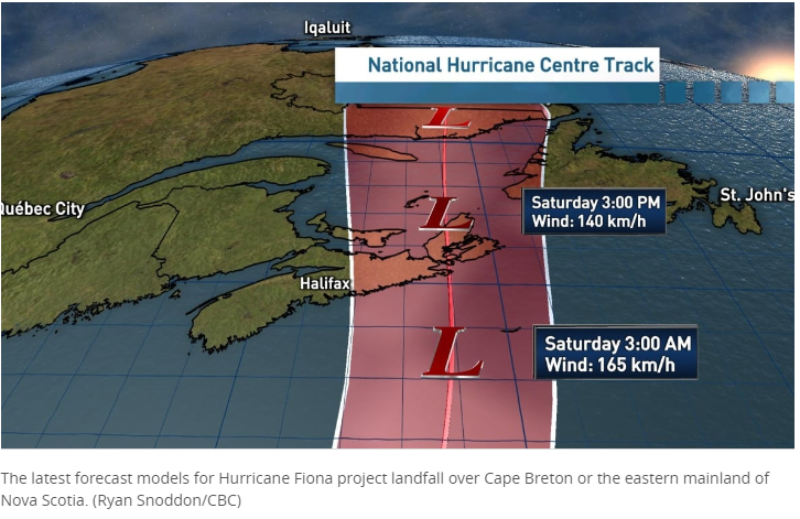
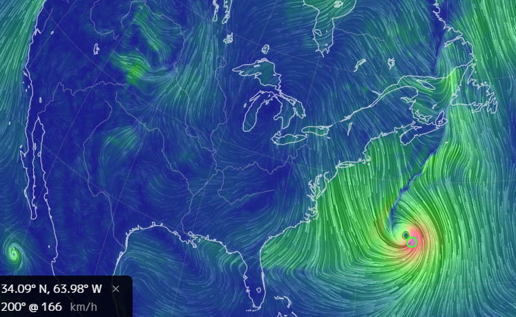
 Concepts of Geographic Thinking: Geographic Perspective, Spatial Significance, Interrelationships , Patterns and Trends
 Concepts of Think: Spatial Significance, Patterns and Trends
 Concepts of Geographic Thinking: Interrelationships, Spatial Significance, Patterns and Trends, Geographic Perspective
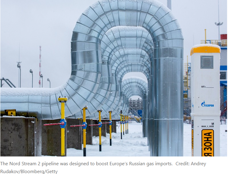
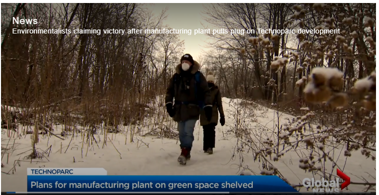


 Concepts of Geographic Thinking: Spatial Significance, Interrelationships, Geographic Perspective
 Concepts of Thinking: Geographic Perspective, Interrelationships, Patterns and Trends, Spatial SignificanceInquiry: How might some Provinces proceed now that they are legally required to create their own carbon tax system if they do not want to follow the Federal Carbon Tax Plan? Why have some Provinces tried to make it hard for Canada to meets its Paris Accord targets by 2030?
 Concepts of Geographic Thinking:

 Concepts of Geographic Thinking:


 Concepts of Geographic Thinking:

 Geographic Concepts of Thinking: Interrelationships, Spatial Significance, Patterns and Trends

 Concepts of Geographic Thinking: Geographic Perspective, Spatial Significance, Interrelationships

 Concepts of Geographic Thinking: Spatial Significance, Patterns and Trends


 Concepts of Geographic Thinking: Interrelationship, Spatial Significance, Geographic Perspective


 Concepts of Thinking: Geographic Perspective, Interrelationships


 Concepts of Geographic Perspective:
Patterns and Trends, Spatial Significance
Concepts of Geographic Perspective:
Patterns and Trends, Spatial Significance

 Concepts of Geographic Thinking:


 Concepts of Thinking: Patterns and Trends

 Concepts of Thinking: Geographic Perspective, Interrelationship

 Concepts of Thinking: Patterns and Trends, Interrelationships, Geographic Perspective, Spatial Significance

 Concepts of Thinking: Interrelationships, Spatial Significance, Geographic Perspective


 Concepts of Thinking: Patterns and Trends, Spatial Significance, Interrelationships


 CONCEPTS OF THINKING: INTERRELATIONSHIPS, SPATIAL SIGNIFICANCE, PATTERNS AND TRENDS
 Concepts of Thinking: Geographic Perspective, Interrelationships, Spatial Significance
 Concepts of Thinking: Interrelationships, Spatial Significance
 CONCEPTS OF THINKING: INTERRELATIONSHIPS, SPATIAL SIGNIFICANCE, PATTERNS AND TRENDS


 Concepts of Thinking: Interrelationships, Geographic Perspective, Patterns and Trends, Spatial Significance


 Concepts of Thinking: Interrelationship, Spatial Significance, Patterns and Trends, and Geographic Perspective


 Concepts of Thinking: Interrelationships, Geographic Perspective, Spatial Significance

 Concepts of Thinking: Interrelationships, Geographic Perspective, Spatial Significance


 2016 is officially the new warmest year on record, edging out previous record holder 2015 by 0.07°F, according to the National Oceanic and Atmospheric Administration. 2016 was the third year in a row that global average surface temperature set a new record.
Credit: NASA
2016 is officially the new warmest year on record, edging out previous record holder 2015 by 0.07°F, according to the National Oceanic and Atmospheric Administration. 2016 was the third year in a row that global average surface temperature set a new record.
Credit: NASA


 Concepts of Thinking: Interrelationships, Spatial Significance, Geographic Perspective

 Concepts of Thinking: Spatial Significance, Geographic Perspective, Patterns and trends

 Concepts of Thinking: Geographic Perspective, Interrelationships

 Concepts of Thinking: Interrelationships, Geographic Perspective, Spatial Significance

 Concept of Thinking: Patterns and Trends, Spatial Significance

 Concepts of Thinking: Interrelationships, Spatial Significance, Patterns and Trends

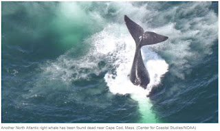 Concepts of Thinking: Interrelationships, Patterns and Trends, Spatial Significance, Geographic Perspective


 Concepts of Thinking: Patterns and Trends, Spatial Significance, Interrelationships


 Concepts of Thinking: Interrelationship, Patterns and Trends, Spatial Significance
 Concepts of Thinking: Spatial Significance, Geographic Perspective


 Concepts of Thinking: Geographic Perspective, InterrelationshipInquiry: Why might antibiotics be used in food? Activity: Gather research on the use of antibiotics in food. Conduct an issue analysis to determine the stakeholders. Make suggestions and communicate via story map.
 Concepts of Thinking: Spatial Significance, Patterns and Trends

 Concepts of Thinking: Spatial Significance, Patterns and Trends
 Concepts of Thinking: Spatial Significance, Patterns and Trends

 Concepts of Thinking: Spatial Significance,
Patterns and Trends, Interrelationships
Concepts of Thinking: Spatial Significance,
Patterns and Trends, Interrelationships


 Concepts of Thinking: Interrelationships, Geographic Perspective, Spatial Significance
 Concepts of Thinking: Spatial Significance, Interrelationships

 Concepts of Thinking: Geographic Perspective, Interrelationships, Spatial Significance
 Concepts of Thinking: Patterns and Trends, Interrelationships, Spatial Significance


 Concepts of Thinking: Patterns and Trends, Interrelations, Spatial Significance
 Concepts of Thinking: Patterns and Trends, Interrelations, Spatial Significance
 Concepts of Thinking: Interrelationships, Spatial Significance, Geographic Perspective, Patterns and Trends
 Concepts of Thinking: Spatial Significance, Patterns and Trends, Interrelationship


 Concepts of Thinking: Spatial Significance, Patterns and Trends


 Concpets of Thinking: Patterns and Trends, Spatial Significance


 Concepts of Thinking: Interrelationships, Spatial Significance, Geographic Perspective, Patterns and Trends

 Concepts of Thinking: Interrelationships, Spatial Significance, Patterns and Trends


 Concepts of Thinking: Spatial Significance, Patterns and Trends


 Concepts of Thinking: Interrelationships, Spatial Significance, Geographic Perspective


 Concepts of Thinking: Spatial Significance, Interrelationships, Geographic Perspective, Patterns and Trends

 Concepts of Thinking: Interrelationships, Spatial Significance, Geographic Perspective, Patterns and Trends

 Concepts of Thinking: Spatial Significance, Patterns and Trends, Interrelationships

 Concepts of Thinking: Geographic Perspective, Spatial Significance, Interrelationships, Patterns and Trends

 Concepts of Thinking; Spatial Significance, Patterns and Trends

 Concepts of Thinking: Spatial Significance, Interrelationships, Geographic Perspective

 Concepts of Thinking: Spatial Significance,
Interrelationships, Geographic Perspective
Concepts of Thinking: Spatial Significance,
Interrelationships, Geographic Perspective

 Concepts of Thinking: Spatial Significance, Interrelationship, Geographic Perspective

 Concepts of Thinking: Geographic Perspective, Interrelationships


 Concepts of Thinking: Spatial Significance, Patterns and Trends, Interrelationship, Geographic Perspective

 Concepts of Thinking: Geographic Perspective, Interrelationships,

 By John Upton

 At Badlands National Park, home to this bison, rangers and other leaders are developing strategies to address diverse scenarios created by climate change.
 Concepts of Thinking: Spatial Significance, Patterns and Trends, Interrelationships, Geographic Perspective


 Concepts of Thinking: Spatial Significance, Interrelationships, Geographic Perspective,
 Concepts of Thinking: Interrelationships, Patterns and Trends, Geographic Perspective, Spatial Significance

 Concepts of Thinking: Interrelationships, Patterns and Trends, Geographic Perspective, Spatial Significance
 Concepts of Thinking: Spatial Significance, Patterns and Trends, Interrelationships, Geographic Perspective
 Concepts of Thinking: Spatial Significance, Patterns and Trends, Interrelationships, Geographic Perspective
 Concepts of Thinking: Interrelationships, Spatial Significance, Geographic Perspectives,


 Concepts of Thinking: Interrelationships, Patterns and Trends, Geographic Perspective

 Concepts of Thinking: Spatial Significance, Interrelationships, Geographic Perspective


 Concepts of Thinking: Geographic Perspective, Spatial Significance, Interrelationships
 Concepts of Thinking: Geographic Perspective, Spatial Significance, Interrelationships
 Concept of Thinking: Spatial Significance, Interrelationships, Patterns and Trends, Geographic perspective
 Concepts of Thinking: Interrelationships, Patterns and Trends, Spatial Significance


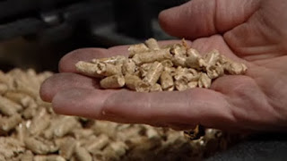 Concepts of Thinking: Geographic Perspective, Interrelationships,

 Concepts of Thinking: Spatial Significance, Patterns and Trends
 Concepts of Thinking: Spatial Significance,
Patterns and Trends, Geographic Perspective, interrelationship
Concepts of Thinking: Spatial Significance,
Patterns and Trends, Geographic Perspective, interrelationship


 Concepts of Thinking: Interrelationships, Patterns and Trends, Spatial Significance
 Concepts of Thinking: Geographic Perspective, Spatial Significance, Interrelationships


 Concepts of Thinking: Spatial Significance, Interrelationships, Geographic Perspective, Patterns and Trends
 Concepts of Thinking: Spatial Significance, Interrelationships, Geographic Perspective, Patterns and Trends
 Concepts of Thinking: Spatial Significance, Interrelationships, Patterns and Trends

 Concepts of Thinking: Spatial Significance, Interrelationships, Patterns and Trends

 Concepts of Thinking: Interrelationships, Geographic Perspective

 Concepts of Thinking: Patterns and Trends, Spatial Significance

 Concepts of Thinking: Interrelationships, Geographic Perspective, Spatial Significance

 CONCEPTS OF THINKING: SPATIAL SIGNIFICANCE, GEOGRAPHIC PERSPECTIVE, PATTERNS AND TRENDS

 Concepts of Thinking: Patterns and Trends, Geographic Perspective, interrelationships, Spatial Significance

 Concepts of Thinking: Spatial Significance, Patterns and Trends

 Concepts of Thinking: Spatial Significance, Patterns and Trends, Interrelationship


 Concepts of Thinking: Spatial Significance, Interrelationships, Patterns and Trends
 Concepts of Thinking: Spatial Significance, Interrelationships, Patterns and Trends
 Concepts of Thinking: Spatial Significance, Geographic Perspective, Patterns and Trends, Interrelationship

 Concepts of Thinking: Spatial Significance, Patterns and Trends, Geographic Perspective

 Concepts of Thinking: Geographic Perspective, Spatial Significance, Patterns and Trends, Interrelationship
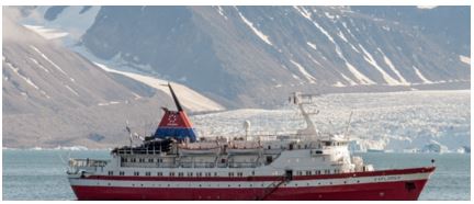 Concepts of Thinking: Geographic Perspective, Spatial Significance, Patterns and Trends, Interrelationship
 Concepts of Thinking: Geographic Perspective, Spatial Significance, Patterns and Trends, Interrelationships

 Concepts of Thinking: Spatial Significance, Patterns and Trends, Geographic Perspective

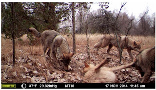
 Concepts of Thinking: Spatial Significance, Interrelationships, Patterns and Trends
 Concepts of Thinking: Spatial Significance, Patterns and Trends, Geographic Perspective

 Concepts of Thinking: Spatial Significance, Patterns and Trends, Geographic Perspective
 Concepts of Thinking: Spatial Significance, Patterns and Trends, interrelationships
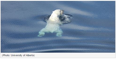
 Concepts of Thinking: Interrelationship, Spatial Significance, Patterns and Trends
 Concepts of Thinking: Spatial Significance, Patterns and Trends, Interrelationship


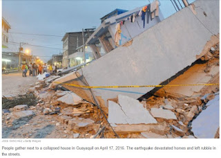 Concepts of Thinking: Spatial Significance, Geographic Perspective, Interrelationships

 Concepts of Thinking: Spatial Significance, Interrelationship, Patterns and Trends


 Concepts of Thinking: Interrelationship, Patterns and Trends

 Concepts of Thinking: Spatial Significance,
Geographic Perspective, Interrelationships
Concepts of Thinking: Spatial Significance,
Geographic Perspective, Interrelationships


 Concepts of Thinking: Geographic Perspective, Interrelationship, Spatial Significance, Patterns and Trends

 Concepts of Thinking: Interrelationships, Spatial Significance, Patterns and Trends
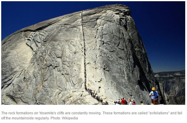

 Concepts of Thinking: Geographic Perspective, Spatial Significance, Patterns and Trends
 Antarctica’s snowfall was expected to keep the ice sheet in balance but it is less stable than previously thought. Photograph: Steve Mandel / Barcroft Media


 Concepts of Thinking: Spatial Significance, Interrelationships


 Concepts of Thinking: Spatial Significance, Interrelationships, Patterns and Trends
 Concepts of Thinking: Spatial Significance, Interrelationships, Patterns and Trends
 Concepts of Thinking: Patterns and Trends, Interrelationships,
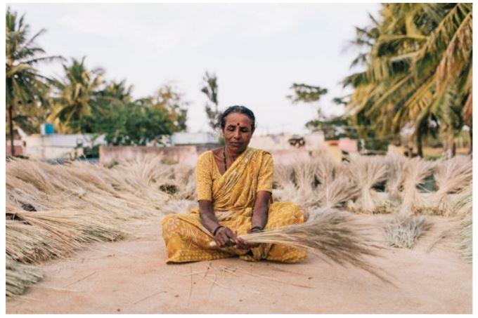
 Concepts of Thinking: Spatial Significance, Interrelationships, Geographic Perspective, Patterns and Trends
 Concepts of Thinking: Interrelationships, Geographic Perspective, Patterns and Trends


 Concepts of Thinking: Interrelationships, Spatial Significance


 Concepts of Thinking: Spatial Significance, Interrelationships

 Concepts of Thinking: Interrelationships, Spatial Significance, Geographic Perspective

 Concepts of Thinking: Spatial Significance, Interrelationships, Geographic Perspective


 Concepts of Thinking: Spatial Significance, Geographic Perspective,
 Concept of Thinking: Interrelationships, Spatial Significance. Patterns and Trends


 Concepts of Thinking: Spatial Significance, Interrelationships, Patterns and Trends, Geographic Perspective

 Concepts of Thinking: Geographic Perspective, Spatial Significance, Interrelationships, Patterns and Trends


 Concepts of Thinking: Interrelationship, Geographic Perspective

 Concepts of Thinking: Spatial Significance, Geographic Perspective, Patterns and Trends
 Concepts of Thinking: Interrelationships, Spatial Significance
Inquiry: Would it be possible that the Rio Olympics be the first in which athletes and countries boycott due to environmental concerns?
Activity: Map out where previous Olympics have been held (What is where?). Determine which ones where boycotted, potentially boycotted and why (Why there?). Evaluate for patterns and trends. Make predictions on future sites and possible concerns (Why care?).
Concepts of Thinking: Interrelationships, Spatial Significance
Inquiry: Would it be possible that the Rio Olympics be the first in which athletes and countries boycott due to environmental concerns?
Activity: Map out where previous Olympics have been held (What is where?). Determine which ones where boycotted, potentially boycotted and why (Why there?). Evaluate for patterns and trends. Make predictions on future sites and possible concerns (Why care?).


 Concepts of Thinking: Geographic Perspective,
Interrelationships
Concepts of Thinking: Geographic Perspective,
Interrelationships
 Concepts of Thinking: Geographic Perspective,

 Concepts of Thinking: Spatial Significance, Interrelationships
 Concepts of Thinking: Spatial Significance, Patterns and Trends, Interrelationships


 Concepts of Thinking: Interrelationship, Spatial Significance, Geographic Perspective, Patterns and Trends
 Concepts of Thinking: Geographic Perspective, Spatial Significance

 Concepts of Thinking: Spatial Significance, Geographic Perspective, Patterns and trends

 Concepts of Thinking: Interrelationships, Spatial Significance, Patterns and Trends

 Concepts of Thinking: Geographic Perspective, Interrelationships

 Concepts of Thinking: Spatial Significance, Patterns and Trends, Interrelationships

 Concepts of Thinking: Geographic Perspective, Interrelationships, Spatial Significance, Patterns and Trends

 Concepts of Thinking: Geographic Perspective, Interrelationships, Spatial Significance

 Concepts of Thinking: Interrelationships, Spatial Significance


 Inquiry: Why is this issue concentrated where it is? What is where? What circumstances a occurred to allow this process to continue? Why there? How might the pattern of worker treatment be addressed? Why care?
Extension Inquiry: What might tomato pickers working conditions be in other parts of the world and how are these conditions addressed?
Inquiry: Why is this issue concentrated where it is? What is where? What circumstances a occurred to allow this process to continue? Why there? How might the pattern of worker treatment be addressed? Why care?
Extension Inquiry: What might tomato pickers working conditions be in other parts of the world and how are these conditions addressed?


 Concepts of Thinking: Patterns and Trends, Spatial Significance,

 Concepts of Thinking: Interrelationships, Spatial Significance, Patterns and Trends

 Concepts of Thinking: Spatial Significance, Patterns and Trends, Interrelationship, Geographic Perspective

 Concepts of Thinking: Geographic Perspective, Spatial Significance


 Concepts of Thinking: Spatial Significance, Patterns and Trends, Interrelationships
 Concepts of Thinking: Spatial Significance, Patterns and Trends, Interrelationships
 Concepts of Thinking: Spatial Significance, Geographic Perspective, Patterns and Trends
 Concepts of Thinking: Interrelationships, Spatial Significance, Patterns and Trends
 Concepts of Thinking: Interrelationships, Patterns and Trends, Spatial Significance, Geographic Perspective


 Concepts of Thinking: Patterns and Trends, Spatial Significance, Geographic Perspective

 Concepts of Thinking: Interrelationships, Spatial Significance, Patterns and Trends

 Concepts of Thinking: Interrelationships, Spatial Significance, Patterns and Trends


 Concepts of Thinking: Interrelationships, Spatial Significance

 Concepts of Thinking: Spatial Significance, Geographic Perspective, Patterns and Trends


 Concepts of Thinking: Spatial Significance, Patterns and Trends, Interrelationships, Geographic Perspective

 Concept of Thinking: Spatial Significance, Patterns and Trends
 Concepts of thinking: Spatial significance, Geographic perspective, Interrelationship
 Concepts of Thinking: Patterns and Trends, Interrelationships
 Concepts of thinking: Spatial significance, Geographic perspective, Interrelationship
 Concepts of Thinking: Patterns and Trends, Interrelationships
 Concepts of Thinking: Interrelationship, Spatial Significance, and Patterns and Trends


 Concepts of Thinking: Interrelationships, Spatial Significance

 Concepts of Thinking: Geographic Perspective, Spatial Significance
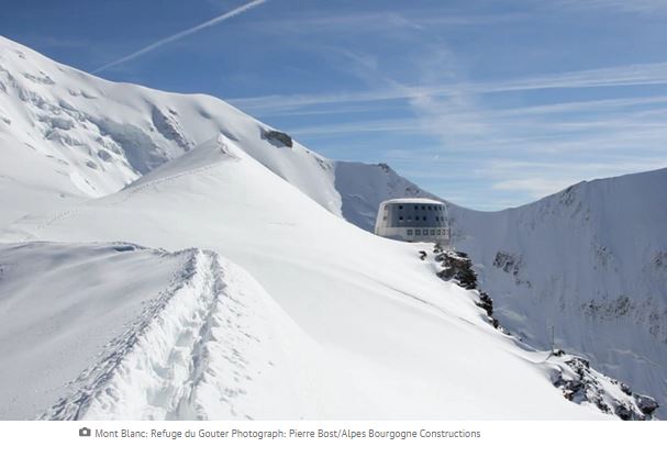


 Concepts of Thinking: Interrelationships, Geographic Perspective,

 Concepts of Thinking: Patterns and Trends, Geographic Perspective, Spatial Significance


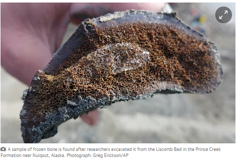


 Concepts of thinking: Spatial significance, geographic perspective, patterns and trends, interrelationships

 Concepts of thinking: Spatial significance, geographic perspective, patterns and trends, interrelationships


 Concepts of Thinking: Geographic Perspective, Spatial Significance,


 Galilee Basin, Australia

 Galilee Basin, Australia


No comments:
Post a Comment